
Balado Bridge Airfield


Airfield (20th Century)
Site Name Balado Bridge Airfield
Classification Airfield (20th Century)
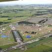
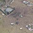
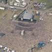
Alternative Name(s) Raf Balado Bridge; T In The Park
Canmore ID 90519
Site Number NO00SE 26
NGR NO 0950 0345
NGR Description Centred NO 0950 0345
Datum OSGB36 - NGR
Permalink http://canmore.org.uk/site/90519


- Council Perth And Kinross
- Parish Kinross
- Former Region Tayside
- Former District Perth And Kinross
- Former County Kinross-shire
NO00SE 26.00 centred 0950 0345
For RAF Balado Bridge Radio Station see NO00SE 38 and the WW II accommodation camp see NO10SW 137
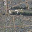
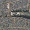
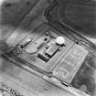
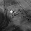
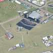
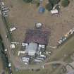
NO00SE 26.01 NO 09709 03608 Control Tower
NO00SE 26.02 NO 09013 03646 Aircraft Hangars
NO00SE 26.03 centred NO 0823 0362 Military Camp
RAF Balado Bridge [NAT]
OS 1:10,000 map, 1985.
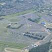
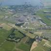
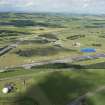
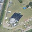
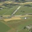
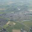
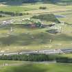
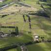
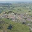
Opened during 1942 as a satellite to Grangemouth (NS98SW 23), and closed for flying in 1957 and all operations were transferred to a new site. Now used as a radio station with aerials inside 'golf-ball' housings (see NO00SE 38). The control tower is still standing on private land.
D J Smith 1983; B Quarrie 1987
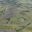
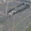
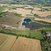
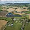
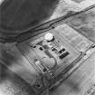
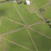
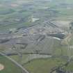
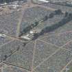
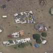
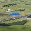
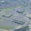
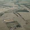
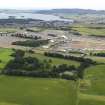
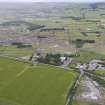
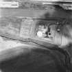
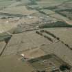
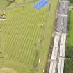
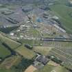
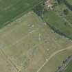
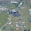
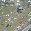
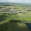
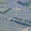
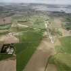
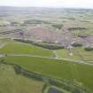
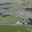
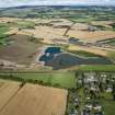
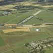
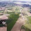
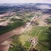
This airfield is situated to the W of Kinross and N of the A977 public road. Some airfield buildings are still extant and the runways now have sheds for battery chickens built on them. A modern radar station (RAF Balado Bridge) consisting of a 'golf-ball' housed aerial has also been constructed immediately to the S of the E-W runway (NN00SE 38).
J Guy 2000; NMRS MS 810/9, 12
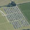
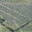
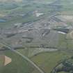
Balado Bridge Airfield is visible on RAF WW II vertical air photographs (NLA 71, 3049-3053, 4051-4054, flown 9 September 1943), and 1947 postwar vertical air photographs(CPE/Scot/UK/290, Pt.III, 5198-5204, flown 2 September 1947). The air photographs show that the airfield only had two runways, not the normal three, though the stub of the third mentioned by Smith can also be seen at the SE corner (Smith 1983). The main aircraft hangar (NO00SE 26.02), and the blister hangars on the perimeter, control tower (NO00SE 26.01) and other ancilliary buildings are all visible, though differences in what appears on the 1943 and 1947 photographs are apparent. A further series of poor quality air photographs taken in 1946 (CPE/Scot/Scot/194, 1249-1252, flown 11 October 1946), show the area in use as a scrapyard, with over 200 aircraft of in varying stages of dismantling dispersed over the the NW part of the airfield.
Accommodation and technical supprt was provided by several dispersed camps, notably the very large area occupied at Turfhills (NO10SW 137) and the smaller Braidmyre Wood camp (NO00SE 26.03).
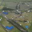
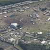
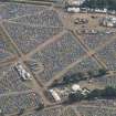
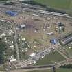
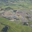
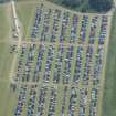
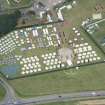
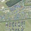
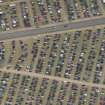
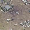
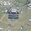
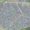
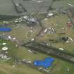
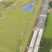
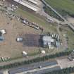
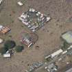
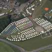
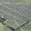
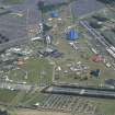
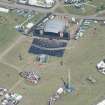
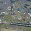
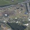
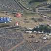
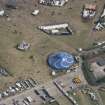
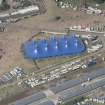
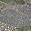
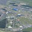
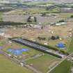
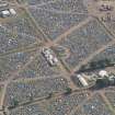
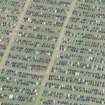
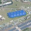
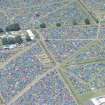
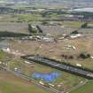
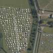
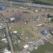
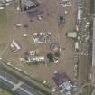
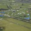
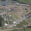
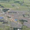
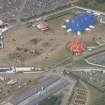
Part of the airfield continues in military use by the RAF as a 'listening station' (NO00SE 38) and at present, part of the rest for annual pop festivals. Most of the main E-W and part of the NE-SW runway are now either partly or wholly occupied by large sheds housing battery chickens and many of the perimeter taxiways can still be seen as can some of the dispersal bays and bases for the blister type hangars.
Information from RCAHMS (DE), September 2005 (visited July 2004)
Standing Building Recording (14 October 2019)
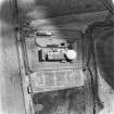
A programme of Historic Building Recording works was undertaken by AKD Archaeology on 14th October 2019, in advance of the demolition and replacement of the Control Tower building at Balado Airfield (MPK: 7782), Kinross. The works were designed to create a competent record of the historic elements of the Control Tower before loss at an Enhanced Level of recording.
The literature associated with the Control Tower confirms that the
pattern of the structure was updated on three separate occasions;
4520/41, 8142/41, 7332/42 (Control Towers.co.uk 2019). It is not
known the exact changes that these pertain to. Although it can be
suggested that there are seven phases in the structures development,
it is possible to record from the survey four phases in the structural
development of the Control Tower.
Information from: Peter Klemen (AKD Archaeology) 23rd October 2019
OASIS ID: akdarcha1-371184

