
Bute, Dunagoil


Field Boundary(S) (Post Medieval), Natural Feature (Period Unknown), Rig And Furrow (Post Medieval)
Site Name Bute, Dunagoil
Classification Field Boundary(S) (Post Medieval), Natural Feature (Period Unknown), Rig And Furrow (Post Medieval)
Canmore ID 90298
Site Number NS05SE 29
NGR NS 0852 5315
NGR Description centre
Datum OSGB36 - NGR
Permalink http://canmore.org.uk/site/90298


- Council Argyll And Bute
- Parish Kingarth
- Former Region Strathclyde
- Former District Argyll And Bute
- Former County Buteshire
NS05SE 29 0852 5315 centre
This site was noted during a coastal zone assessment survey undertaken by CFA Archaeology Ltd to characterise the state of coastal erosion and the threat it poses to cultural heritage sites. A gazetteer in the report included a note of existing records and new sites when discovered. Where the site was located, notes included condition, period/date and recommendations.
Commissioned by The Scape Trust and Firth of Clyde Forum on behalf of Historic Scotland.
Cressey and Johnson 2004
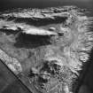
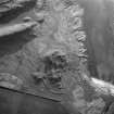
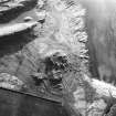
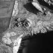
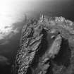
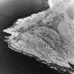
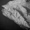
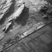
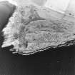
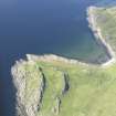
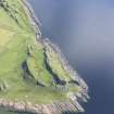
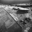
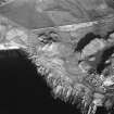
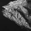
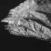
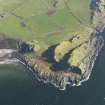
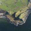
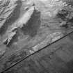
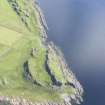
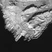
At least two patches of rig and fragmentary field banks have been recorded on oblique aerial photography (RCAHMSAP 1993, 1999) around a rocky outcrop, immediately to the NE and E of Dunagoil Fort (NS05SE 4).
Information from RCAHMS (KMM) 13 January 2005
Measured Survey (1780)
Field Visit (25 May 1943)
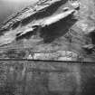
The large mound that stands in the hollow NE of Dunagoil Fort seems to possess a core of natural rock which crops out on the NW side. It can therefore hardly be regarded as an ancient monument, notwithstanding its artificial appearance, the fondness of rabbits for its soil, and the presence in it of many loose stones.
Visited by RCAHMS (AG) 25 May 1943
Field Visit (December 2003)
This site was noted during a coastal zone assessment survey undertaken by CFA Archaeology Ltd to characterise the state of coastal erosion and the threat it poses to cultural heritage sites. A gazetteer in the report included a note of existing records and new sites when discovered. Where the site was located, notes included condition, period/date and recommendations.
Commissioned by The Scape Trust and Firth of Clyde Forum on behalf of Historic Scotland.
Cressey and Johnson 2004
Reference (2004)
Field Visit (20 March 2009)
Rig-and-furrow cultivation (centred on NS 0852 5315) is visible in flattish areas of ground between the volcanic ridge surmounted by the vitrified fort NS05SE 4 and another craggy ridge immediately N. The individual, slightly curving, rigs measure up to 3m in breadth and are orientated roughly NW and SE. Other patches of rig are visible in the vicinity, including one (centred at NS 0851 5318), in which the straight rigs measure up to 3.5 metres in breadth and are aligned N and S. Some of the rig in the area is enclosed by thick banks, which were described by Harding, in his recent reappraisal (2004), as part of the main vitrified Iron Age fort.
Visited by RCAHMS (GFG, AGCH, ARG, IP) 20 March 2009.

