|
Photographs and Off-line Digital Images |
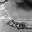
C 11110 |
RCAHMS Aerial Photography |
Oblique aerial view
Filed in archaeology box file |
1993 |
Item Level |
|
|
Photographs and Off-line Digital Images |
C 11111 |
RCAHMS Aerial Photography |
Oblique aerial view
Filed in archaeology box file |
1993 |
Item Level |
|
|
Photographs and Off-line Digital Images |
C 11112 |
RCAHMS Aerial Photography |
Oblique aerial view
Filed in archaeology box file |
1993 |
Item Level |
|
|
Photographs and Off-line Digital Images |
C 11113 |
RCAHMS Aerial Photography |
Oblique aerial view. |
1993 |
Item Level |
|
|
Photographs and Off-line Digital Images |
C 47689 |
Records of the German Air Force (Luftwaffe), Second World War Aerial Reconnaissance |
Tranent, Macmerry airfield aerial view. |
2/1942 |
Item Level |
|
|
Photographs and Off-line Digital Images |
C 47689 S |
Records of the German Air Force (Luftwaffe), Second World War Aerial Reconnaissance |
Tranent, Macmerry airfield aerial view. |
2/1942 |
Item Level |
|
|
Photographs and Off-line Digital Images |
C 91324 CS |
|
Macmerry Airfield, dispersal bays with staggered throughways and air raid shelter. |
10/5/1996 |
Item Level |
|
|
Photographs and Off-line Digital Images |
C 91325 CS |
|
Macmerry Airfield, dispersal pen with staggered throughway with air raid shelter |
10/5/1996 |
Item Level |
|
|
Photographs and Off-line Digital Images |
C 91326 CS |
|
Macmerry Airfield, double dispersal bay with staggered throughways and air raid shelter. |
10/5/1996 |
Item Level |
|
|
Photographs and Off-line Digital Images |
C 91327 CS |
|
Macmerry Airfield, dispersal bay showing hardstand and staggered throughway with air raid shelter. |
10/5/1996 |
Item Level |
|
|
Photographs and Off-line Digital Images |
C 91330 CS |
|
Macmerry Airfield, perimeter brick-built building for air crew. |
10/5/1996 |
Item Level |
|
|
Photographs and Off-line Digital Images |
C 91332 CS |
|
Macmerry Airfield, building to W of pillbox NT47SW 46.01 |
10/5/1996 |
Item Level |
|
|
Photographs and Off-line Digital Images |
C 94365 CS |
|
Macmerry airfield, protected dispersal bays looking NE. |
10/5/1996 |
Item Level |
|
|
Photographs and Off-line Digital Images |
C 91328 CS |
|
Macmerry Airfield, pillbox and brick-built building on the N side of old A1 trunk road. |
10/5/1996 |
Item Level |
|
|
Manuscripts |
MS 810/5 |
Records of Historic Scotland, Edinburgh, Scotland |
Lothian Region - A survey of 20th Century Defences in the Lothian region. A survey by John Guy. |
1997 |
Item Level |
|
|
Photographs and Off-line Digital Images |
C 56743 |
RCAHMS Aerial Photography |
Greendykes, oblique aerial view, taken from the NNE, centred on the cropmarks of a settlement adjacent to the footings of buildings related to MacMerry Airfield. |
27/6/1996 |
Item Level |
|
|
Photographs and Off-line Digital Images |
C 56744 |
RCAHMS Aerial Photography |
Greendykes, oblique aerial view, taken from the NW, centred on the cropmarks of a settlement adjacent to the footings of buildings related to MacMerry Airfield. |
27/6/1996 |
Item Level |
|
|
Photographs and Off-line Digital Images |
C 56745 |
RCAHMS Aerial Photography |
Greendykes, oblique aerial view, taken from the WSW, centred on the cropmarks of a settlement adjacent to the footings of buildings related to MacMerry Airfield. |
27/6/1996 |
Item Level |
|
|
Photographs and Off-line Digital Images |
C 56746 |
RCAHMS Aerial Photography |
Greendykes, oblique aerial view, taken from the S, centred on the cropmarks of a settlement adjacent to the footings of buildings related to MacMerry Airfield. |
27/6/1996 |
Item Level |
|
|
Manuscripts |
MS 879/9 |
|
Photocopy of an article titled 'A History of RAF Macmerry'. |
c. 10/1999 |
Item Level |
|
 |
On-line Digital Images |
SC 882037 |
RCAHMS Aerial Photography |
Oblique aerial view. |
1993 |
Item Level |
|
|
Photographs and Off-line Digital Images |
D 74661 |
RCAHMS Aerial Photography |
Oblique aerial view centred on the cropmarks of the settlement with the remains of buildings adjacent, taken from the SSW. |
27/7/2000 |
Item Level |
|
|
Photographs and Off-line Digital Images |
D 74662 |
RCAHMS Aerial Photography |
Oblique aerial view centred on the cropmarks of the settlement with the remains of buildings adjacent, taken from the WSW. |
27/7/2000 |
Item Level |
|
|
Photographs and Off-line Digital Images |
D 74663 |
RCAHMS Aerial Photography |
Oblique aerial view centred on the cropmarks of the settlement with the remains of buildings adjacent, taken from the WNW. |
27/7/2000 |
Item Level |
|


