
Sinclair's Bay


Pillbox (20th Century)
Site Name Sinclair's Bay
Classification Pillbox (20th Century)
Alternative Name(s) Sinclair's Bay Defences; Wic 124
Canmore ID 89756
Site Number ND35NW 28
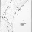
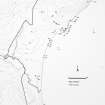
NGR ND 3431 5619
Datum OSGB36 - NGR
Permalink http://canmore.org.uk/site/89756


- Council Highland
- Parish Wick
- Former Region Highland
- Former District Caithness
- Former County Caithness
ND35NW 28 3431 5619
Dimensions, length exposed 4m, 0.6m deep. Located in dune section, the base of the pillbox and some walling. Elevation c.5m. Eastern aspect.
C Batey, Caithness Coastal Survey 1981.
Project (1980 - 1982)
Field Visit (1981)
Dimensions, length exposed 4m, 0.6m deep. Located in dune section, the base of the pillbox and some walling. Elevation c.5m. Eastern aspect.
C Batey, Caithness Coastal Survey 1981.

