
Ham, Kirk Geo


Chapel (Period Unassigned)
Site Name Ham, Kirk Geo
Classification Chapel (Period Unassigned)
Alternative Name(s) Dun 008
Canmore ID 8913
Site Number ND27SW 7
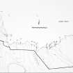
NGR ND 2365 7393
Datum OSGB36 - NGR
Permalink http://canmore.org.uk/site/8913


- Council Highland
- Parish Dunnet
- Former Region Highland
- Former District Caithness
- Former County Caithness
ND27SW 7 2365 7393.
(ND 2365 7393) Chapel (NR) (site of)
OS 1:10,000 map, (1976)
This small piece of uncultivated land, 50 links square, is traditionally the site of a chapel where traces of a wall foundation and several large old weatherbeaten stones appear above ground surface (Ordnance Survey Name Book [ONB] 1872). These traces are the remains of some structure, said to be a chapel (RCAHMS 1911).
Name Book 1872; RCAHMS 1911.
The remains of this chapel are now completely grass- covered, and the site is only visible as a slight rise in the centre of the uncultivated area in the corner of an arable field. No further information could be obtained locally.
Visited by OS (R D) 26 February 1965.
No dimensions available because of the almost total destruction of the site.
C E Batey 1982.
No change to the previous field report.
Visited by OS (J M) 22 April 1982.
Project (1980 - 1982)
Field Visit (1982)
No dimensions available because of the almost total destruction of the site.
C E Batey 1982.

