
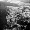
Backies


Farmstead (Period Unassigned), Field System (Period Unassigned)
Site Name Backies
Classification Farmstead (Period Unassigned), Field System (Period Unassigned)
Canmore ID 88452
Site Number NC80SW 33.03
NGR NC 8354 0231
Datum OSGB36 - NGR
Permalink http://canmore.org.uk/site/88452


- Council Highland
- Parish Golspie
- Former Region Highland
- Former District Sutherland
- Former County Sutherland
NC80SW 33.03 8354 0231
(Previously NC80SW 47)
A farmstead comprising one roofed and one unroofed building and a field-system are depicted on the 1st edition of the OS 6-inch map (Sutherland 1876, sheet cv). An unroofed building is shown on the current edition of the OS 1:10,560 map (1969).
Information from RCAHMS (SAH) 4 December 1995

