
Aberdeen, Victoria Road, Victoria Bridge


Road Bridge (19th Century)
Site Name Aberdeen, Victoria Road, Victoria Bridge
Classification Road Bridge (19th Century)
Alternative Name(s) River Dee; Market Street
Canmore ID 87079
Site Number NJ90NW 304
NGR NJ 94680 05460
Datum OSGB36 - NGR
Permalink http://canmore.org.uk/site/87079


- Council Aberdeen, City Of
- Parish Aberdeen
- Former Region Grampian
- Former District City Of Aberdeen
- Former County Aberdeenshire
NJ90NW 304 94680 05460
Victoria Bridge [NAT]
OS (GIS) MasterMap, July 2010.
NMRS REFERENCE:
Aberdeen, Victoria Bridge.
Architects: Edward LJ Blyth 1872, opened 1881.
(Undated) information in NMRS.
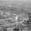
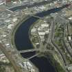
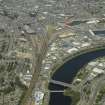
(Location cited as NJ 947 054). Victoria Bridge. Completed 1881, engineer J H Blyth. A five-span segmental-arched bridge of dressed-stone construction, with polished granite parapet. The cutwaters are rounded.
J R Hume 1977.
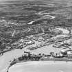
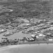
In 1868 the Dee was diverted to its present course, the Council proposing to build a bridge over the Dee and open up the area for development. In 1876, after 32 people died in a ferry-boat accident, the bridge idea was taken up in earnest with the construction of the Victoria Bridge.
NMRS, MS/712/83.
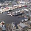
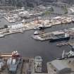
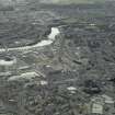
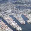
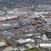
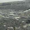
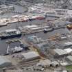
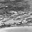
Victoria Bridge carries Victoria Road (which forms the southern extension of Market Street and the A945 public road) over the River Dee to the S of the city centre of Aberdeen.
Information from RCAHMS (RJCM), 2 July 1999.

