
Allt Coire Uchdachan Bridge


Road Bridge (Period Unassigned)
Site Name Allt Coire Uchdachan Bridge
Classification Road Bridge (Period Unassigned)
Alternative Name(s) Corriey Airack Pass
Canmore ID 83032
Site Number NH30SE 3
NGR NH 39261 00312
Datum OSGB36 - NGR
Permalink http://canmore.org.uk/site/83032


- Council Highland
- Parish Boleskine And Abertarff
- Former Region Highland
- Former District Inverness
- Former County Inverness-shire
NH30SE 3 3926 0031.
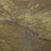
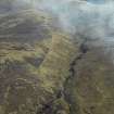
NH 392 003 Uchdachan Bridge is a single span arched bridge, built between 1731-32 across the Allt Coire Uchdachan on General Wade's road, running N from Dalwhinnie to Fort Augustus. Due to subsidence of the arch the bridge is in a state of disrepair, and so a programme of archaeological recording was undertaken, prior to repair work being carried out.The bridge is oriented approximately E-W, built onto unlevelled bedrock and subsoil. It is a predominantly drystone structure, with some mortar rendering in places, and is composed of micaceous rocks, with the occasional granite slab. The angular stone is probably derived from a local quarry, possibly the quarry situated beside the next bridge to the N along Wade's road. The span of the arch, spandrel to spandrel, measures 5.8m, and the bridge stands to a maximum height of 2.9m.
Two trenches were opened, trench 1, measuring c90cm by 90cm against the N parapet at the western end of the bridge and Trench 2, measuring c50cm by 50cm at the approximate centre of the span. Both trenches revealed a layer of dumped material representing an infill of the basic frame of the bridge.
No evidence of a clay lining was found, and the upper surfaces of the arch revealed in Trench 2 indicate that the build was quite irregular (although the visible arch was more finely faced). The parapet created by the side walls is still visible above the turf line in places, and it may once have stood some courses higher.
Sponsor: Association for the Protectin of Rural scotland.
G Ewart, D Murray and D Connolly 1995.
NH 3926 0031 Further monitoring was undertaken by Kirkdale Archaeology during 1996 on the 18th-century Wade bridge. A photogrammetric record was made in advance of consolidation, and a survey record was made of exposed surfaces and features.
Sponsor: APRS Edinburgh.
G Ewart, D Murray and A Hollinrake 1996
Excavation (29 August 1995 - 30 August 1995)
NH 392 003 Uchdachan Bridge is a single span arched bridge, built between 1731-32 across the Allt Coire Uchdachan on General Wade's road, running N from Dalwhinnie to Fort Augustus. Due to subsidence of the arch the bridge is in a state of disrepair, and so a programme of archaeological recording was undertaken, prior to repair work being carried out.The bridge is oriented approximately E-W, built onto unlevelled bedrock and subsoil. It is a predominantly drystone structure, with some mortar rendering in places, and is composed of micaceous rocks, with the occasional granite slab. The angular stone is probably derived from a local quarry, possibly the quarry situated beside the next bridge to the N along Wade's road. The span of the arch, spandrel to spandrel, measures 5.8m, and the bridge stands to a maximum height of 2.9m.
Two trenches were opened, trench 1, measuring c90cm by 90cm against the N parapet at the western end of the bridge and Trench 2, measuring c50cm by 50cm at the approximate centre of the span. Both trenches revealed a layer of dumped material representing an infill of the basic frame of the bridge.
No evidence of a clay lining was found, and the upper surfaces of the arch revealed in Trench 2 indicate that the build was quite irregular (although the visible arch was more finely faced). The parapet created by the side walls is still visible above the turf line in places, and it may once have stood some courses higher.
Sponsor: Association for the Protection of Rural scotland.
G Ewart, D Murray, and D Connolly 1995
Kirkdale Archaeology
Standing Building Recording (5 August 1996 - 30 August 1996)
NH 3926 0031 Further monitoring was undertaken by Kirkdale Archaeology during 1996 on the 18th-century Wade bridge. A photogrammetric record was made in advance of consolidation, and a survey record was made of exposed surfaces and features.
Sponsor: APRS Edinburgh.
G Ewart, D Murray and A Hollinrake 1996
Kirkdale Archaeology

