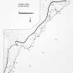
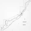
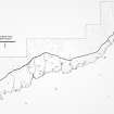
Latheronwheel Tower
Beacon (Period Unassigned)
Site Name Latheronwheel Tower
Classification Beacon (Period Unassigned)
Alternative Name(s) Lat 260; Latheron Wheel, Light House; Latheronwheel Harbour, Lighthouse; Latheron Harbour, Light Tower
Canmore ID 8177
Site Number ND13SE 57
NGR ND 1903 3206
Datum OSGB36 - NGR
Permalink http://canmore.org.uk/site/8177
- Council Highland
- Parish Latheron
- Former Region Highland
- Former District Caithness
- Former County Caithness
ND13SE 57 1903 3206
For Latheronwheel Harbour (ND 19130 32120), see ND13SE 63.00.
Light house. A small building overlooking the harbour, disused by 1871.
Name Book 1871; OS 6" map, Caithness, 1st ed., (1871)
A modern look-out tower, five-sided and mostly ruinous but with one wall standing to a height of about 2m. It measures 7.3m by 5.5m in maximum dimensions, with walls 0.6m thick.
J Humphries 1968; C Batey 1982.
ND 1904 3205. Irregular six-sided structure sides vary between 1.9m to 4.9m in length - its 0.7m thick wall of dressed blocks reduced to the base courses except for the most north-easterly angle where it stands 2.6m high. Stone debris fills the interior and litters the surrounding area.
Visited by OS, 15 October 1982.
Project (1980 - 1982)
Field Visit (15 October 1982)
ND 1904 3205. Irregular six-sided structure sides vary between 1.9m to 4.9m in length - its 0.7m thick wall of dressed blocks reduced to the base courses except for the most north-easterly angle where it stands 2.6m high. Stone debris fills the interior and litters the surrounding area.
Visited by OS 15 October 1982.


