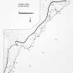
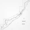
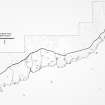
Berriedale Navigation Beacons, North Tower
Tower (19th Century)
Site Name Berriedale Navigation Beacons, North Tower
Classification Tower (19th Century)
Alternative Name(s) Lat 298a
Canmore ID 8084
Site Number ND12SW 25
NGR ND 11991 22331
Datum OSGB36 - NGR
Permalink http://canmore.org.uk/site/8084
- Council Highland
- Parish Latheron
- Former Region Highland
- Former District Caithness
- Former County Caithness
ND12SW 25.00 11969 22331
ND12SW 25.01 ND 11807 22208 tower
Two towers either round or square set a furlong apart and said to be built of land clearance stones although Batey (1982) doubts this.
The more northerly is 6.5m high and the other 5m high and severely damaged on the south side.
Both sites are annotated 'Survey Control Point' on the OS 6" map, Caithness, 1st ed., 1871 but they are not noted in the Name Book.
D MacDonald, A Polson and J Brown 1931; C Batey 1982.
This is the north tower, not be confused with ND12SW 25.01, ND11807 22908
Project (1980 - 1982)


