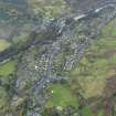
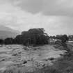
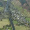
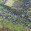
Killin, General
Burgh (Medieval), Village (Period Unassigned)
Site Name Killin, General
Classification Burgh (Medieval), Village (Period Unassigned)
Alternative Name(s) Falls Of Dochart; River Dochart; Loch Tay
Canmore ID 78139
Site Number NN53SE 37
NGR NN 57315 33073
NGR Description Centred NN 57315 33073
Datum OSGB36 - NGR
Permalink http://canmore.org.uk/site/78139
- Council Stirling
- Parish Killin
- Former Region Central
- Former District Stirling
- Former County Perthshire
NN53SE 37 centred 57315 33073
For Bridge of Dochart (NN 5713 3250), see NN53SE 51.
Erected burgh of barony 1694.
G S Pryde 1965.
NMRS REFERENCE:
Killin Parish (traced from unfinished plans by Ordnance Survey)
PLANS:
Dick Peddie & MacKay, Edinburgh
Bin 12, Bag 1 n.s. n.d.
EXTERNAL REFERENCE:
Killin, Monument
SCOTTISH RECORD OFFICE
GD 112/5 Vouchers of Factors Accounts 1643 - 1797
476/35 Due to Alexander Laing, Edinburgh for drawings plans of a monument, gates, parapets and railings, 1797


