
Errol Airfield, Se Dispersals


Aircraft Hangar(S) (20th Century), Dispersal Bay(S) (20th Century)
Site Name Errol Airfield, Se Dispersals
Classification Aircraft Hangar(S) (20th Century), Dispersal Bay(S) (20th Century)
Canmore ID 76535
Site Number NO22SE 18.01
NGR NO 27300 23520
NGR Description Centred NO 27300 23520
Datum OSGB36 - NGR
Permalink http://canmore.org.uk/site/76535


- Council Perth And Kinross
- Parish Errol
- Former Region Tayside
- Former District Perth And Kinross
- Former County Perthshire
NO22SE 18.01 centred 27300 23520
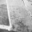
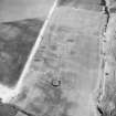
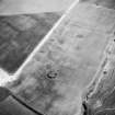
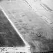
The SE dispersal area is visible on RAF WW II vertical air photographs (NLA 68, 3089-3091, 4088-4092, flown 27 August 1943). Three blister hangars and four circular concrete bays are visible in this area on the photographs.
From more recent air photography, nothing can be seen on the surface in this the area, but cropmarks of what lies beneath the surface are visible on oblique air photographs taken in 1985 (RCAHMSAP 1985) and vertical air photographs taken in 1988 (All Scotland Survey 50788 226-227, flown 10 June 1988).
Information from RCAHMS (DE), September 2005

