
North Sutor, Coast Battery


Coastal Battery (Second World War), Coastal Battery(S) (First World War)
Site Name North Sutor, Coast Battery
Classification Coastal Battery (Second World War), Coastal Battery(S) (First World War)
Alternative Name(s) Cromarty Defences; Fort North Sutor; Site No. 1; Site No. 2
Canmore ID 75579
Site Number NH86NW 9
NGR NH 81955 68924
NGR Description Centred NH 81955 68924
Datum OSGB36 - NGR
Permalink http://canmore.org.uk/site/75579


- Council Highland
- Parish Nigg (Ross And Cromarty)
- Former Region Highland
- Former District Ross And Cromarty
- Former County Ross And Cromarty
NH86NW 9.00 centred 81956 68924
NH86NW 9.01 NH 8282 6979 Radar Site; Engine Houses
NH86NW 9.02 NH 81955 68924 and NH 81989 68962 Gun-Emplacements
NH86NW 9.03 NH 82146 68966 Observation Post
NH86NW 9.04 NH 81230 68695 and NH 81304 68689 Gun Emplacements
NH86NW 9.05 NH 8210 6872 and NH 8213 6874 Searchlight Battery; Engine House
NH86NW 9.06 NH 8200 6898 and NH 8195 6893 Gun-emplacements
NH86NW 9.07 NH 82158 68965 Observation Post
NH86NW 9.08 NH 82564 69519 and NH 82547 69512 Observation Post; Engine House
NH86NW 9.09 Centred NH 81844 69195 Huts; Water Tank
NH86NW 9.10 NH 81865 68976 Pillbox
NH86NW 9.11 NH 82129 69008 Operations Block
NH86NW 9.12 NH 81984 68986 Building
NH86NW 9.13 NH 81844 68946 Engine House
NH86NW 9.14 NH 81964 69000 Pillbox
NH86NW 9.15 Cancelled see NH86NW 9.05
NH86NW 9.16 NH 81238 68740 Engine House
NH86NW 9.17 NH 81125 68680 and NH 81138 68683 Searchlight Battery
NH86NW 9.18 Centred NH 81298 68721 Military Camp
NH86NW 9.19 Centred NH 81895 68963 Military Camp
NH86NW 9.20 NH 81880 68915 Naval Signal Station
NH86NW 9.21 Centred NH 81862 68899 Rocket Projector Battery
NH86NW 9.22 NH 82286 68982 Engine House
NH86NW 9.23 NH 82144 68794 Engine House (possible)
NH86NW 9.24 NH 82286 68982 Foghorn
NH86NW 9.25 NH 82216 69005 Machine Gun Post
NH86NW 9.26 NH 81515 68772 Weapons Pit
NH86NW 9.27 NH81510 68758 Weapons Pit
NH86NW 9.28 NH 81462 68773 Platform
NH86NW 9.29 NH 81408 68754 Submarine Mining Station
NH86NW 9.30 NH 81335 68751 Gateway
NH86NW 9.31 NH 81273 68742 Mound
NH86NW 9.32 NH 81516 68806 Fence; Gateway
NH86NW 9.33 NH 81284 68734 Building
NH86NW 9.34 NH 81272 68730 Building
NH86NW 9.35 NH 81333 68718 Ablutions Block
NH86NW 9.36 NH 81299 68721 Barracks
NH86NW 9.37 NH 81269 68724 Building
NH86NW 9.38 NH 81251 68727 Wall
NH86NW 9.39 NH 81268 68704 Mess
NH86NW 9.40 NH 81225 68711 Building Platform
NH86NW 9.41 NH 81352 68739 Building Platform
NH86NW 9.42 NH 81214 68711 Radio Mast
NH86NW 9.43 NH 81205 68712 Latrine
NH86NW 9.44 NH 81230 68692 Radio Mast
NH86NW 9.45 NH 81267 68696 Observation Post
NH86NW 9.46 NH 81279 68669 Building Platforms
NH86NW 9.47 NH 81277 68713 Drains
NH86NW 9.48 NH 81544 68806 Military Road
NH86NW 9.49 NH 82238 69003 Weapons Pit
NH86NW 9.50 NH 82238 69009 Weapons Pit
NH86NW 9.51 NH 82096 69029 Fence
NH86NW 9.52 NH 82127 69035 Weapons Pit
NH86NW 9.53 NH 82126 69029 Weapons Pit
NH86NW 9.56 NH 82056 69021 Weapons Pit
NH86NW 9.57 NH 81991 69003 Building Platform
NH86NW 9.58 NH 81978 68998 Guardhouse
NH86NW 9.59 NH 81969 68949 Command Post
NH86NW 9.60 NH 81914 68892 Weapons Pit
NH86NW 9.61 NH 81846 68874 Weapons Pit
NH86NW 9.62 NH 81848 68860 Weapons Pit
NH86NW 9.63 NH 81855 68848 Weapons Pit
NH86NW 9.64 NH 81864 68853 Weapons Pit
NH86NW 9.65 NH 81820 68846 Weapons Pit
NH86NW 9.66 NH 81803 68849 Weapons Pit
NH86NW 9.67 NH 81806 68805 Engine House
NH86NW 9.68 NH 81768 68821 Building Platform
NH86NW 9.70 NH 81655 68832 Incinerator
NH86NW 9.71 NH 81660 68817 Drying House
NH86NW 9.72 NH 81686 68842 Weapons Pit
NH86NW 9.74 NH 81789 68877 Storehouse
NH86NW 9.75 NH 81784 68928 Mess
NH86NW 9.77 NH 81967 69000 Gate
NH86NW 9.78 NH 81860 68732 Hydrophone Station
NH86NW 9.79 NH 8182 6896 Boundary Stone
NH86NW 9.80 NH 82124 69036 Boundary Stone
NH86NW 9.81 NH 82539 69518 Boundary Stone
NH86NW 9.82 NH 82550 69511 Boundary Stone
NH86NW 9.83 NH 82569 69528 Boundary Stone
NH86NW 9.84 NH 82579 69521 Boundary Stone
NH86NW 9.85 NH 82828 69815 Boundary Stone
NH86NW 9.86 NH 81811 68941 Building
NH86NW 9.87 NH 81827 68928 Building
NH86NW 9.88 NH 81841 68908 Enclosure
NH86NW 9.89 NH 81855 68958 Reservoir
NH86NW 9.90 NH 81869 68960 NAAFI Building
NH86NW 9.91 NH 81872 68952 Building
NH86NW 9.92 NH 81876 68941 Building
NH86NW 9.93 NH 81888 68963 NAAFI Building
NH86NW 9.94 NH 81894 68946 Mess
NH86NW 9.95 NH 81914 68946 Bath House
NH86NW 9.96 NH 81920 68969 Building
NH86NW 9.97 NH 81925 68948 Storehouse
NH86NW 9.98 NH 81945 68976 Army Offices
NH86NW 9.99 NH 81946 68964 Building
NH86NW 22.01 NH 81939 68952 Reservoir
NH86NW 22.02 NH 81963 68982 Building
NH86NW 22.03 NH 81960 68994 Military Signalling Site
NH86NW 22.04 NH 81882 68978 Barracks
NH86NW 22.05 NH 81760 68932 Gate
NH86NW 22.06 NH 81769 68923 Storehouse
NH86NW 22.07 NH 81777 68927 Garage
NH86NW 22.08 NH 81807 68914 Building
NH86NW 22.09 NH 81800 68898 Canteen; Offices
NH86NW 22.10 NH 81828 68921 Guardhouse
NH86NW 22.11 NH 81840 68905 Building
NH86NW 22.12 NH 81844 68934 Engine House
NH86NW 22.13 NH 81905 68927 Building
NH86NW 22.14 NH 81854 68957 Latrines
NH86NW 22.15 NH 81866 68960 Coal Store; Storehouse
NH86NW 22.16 NH 81904 68967 Barracks
NH86NW 22.17 NH 81833 68974 Building
NH86NW 22.18 NH 81940 68978 Storehouse
NH86NW 22.19 NH 81896 68948 Barracks
NH86NW 22.20 NH 81920 68954 Building
NH86NW 22.21 NH 81926 68957 Storehouse
NH86NW 22.22 NH 81960 68980 Mess
NH86NW 22.23 NH 81948 68963 Carpenters Workshop
NH86NW 22.24 NH 81876 69174 Trench
NH86NW 22.25 NH 82495 69444 Military Road
NH86NW 22.27 NH 81970 68994 Fence
NH86NW 22.28 NH 81970 68994 Gateway
NH86NW 22.29 NH 81825 68957 Gateway
NH86NW 22.30 NH 81880 68940 Military Roads
NH86NW 22.31 NH 81970 68990 Military Roads
NH86NW 22.32 NH 81955 68924 Trenches
NH86NW 22.33 NH 81857 68953 Latrine (possible)
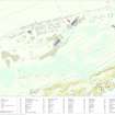
There are two groups of buildings at the edge of the cliff, deeply set in concrete which held various calibres of guns. The site was used both in the First and Second World Wars.
Information from RCAHMS (DE) September 1994.
NH 816 686 for coastline turrets.
CFA/MORA Coastal Assessment Survey 1998.
This WW I and WW II coast battery encompasses several elements; gun-emplacements, WW I and II Battery Observation posts, searchlight platforms, a Radar Observation post, a WW I 4-inch gun quick firing (QF) battery with searchlights and a WW II Counter Bombardment Observation Post. All are situated on a level area to the S of Castlecraig Farmsteading.
In addition, four Unrotating Projectile (UP) mountings were noted to the SW on the date of visit with several surviving elements of the accommodation camp including the electricity generating house (standby-set house), many concrete hut bases and the remains of two defensive pillboxes.
Several of the buildings retain a camouflage pattern and there is eveidence of the phasing in one of the emplacements. The canopies of both WW II emplacements have been supported by brick built pillars and the front apron has been camouflaged by setting stones in concrete. Metal gun stops still survive on the apron.
Known locally as the 'Norwegian Battery'. During WW I it was provided with two former ship mounted 9.2-inch guns which were manned by the Royal Navy. This battery was abandoned during the inter-war period, but at the beginning of WW II was re-armed. The WW II battery re-used the earlier magazine, which was situated below WW I emplacements and a shell hoist was installed in the 9.2-inch barbette. Two 6-inch Mk VII guns were installed during 1940 in newly constructed emplacements and these were replaced in April 1943 by two 6-inch Mk XXIV guns. After the end of the Second World War, the battery placed on a care and maintenance basis and the guns were finally removed during November 1956.
The full extent of the main batteries (omitting the WW I 4-inch QF) is visible on RAF vertical air photographs (106G/UK751, 6038-6040, flown 31 August 1945). which also shows the UP positions.
Visited by RCAHMS (DE, GS, SW), August 2000
Several lengths of the original perimeter fence still surmounted by barbed wire survive on the N and E of the site.
Visited by RCAHMS, (DE) May 2002.
Note (26 July 2013)
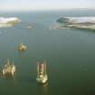
Plans were drawn up in 1913 for the construction of coast defences on the North Sutor to protect the fleet anchorage in the Cromarty Firth. The main armament on the North Sutor was a pair of 9.2-inch guns (NH86NW 9.02), the calibre of coast guns intended to tackle the largest size of enemy warship that might attack. There was also a battery of four 4-inch Quick Firing guns (NH86NW 9.04), intended to tackle smaller, faster-moving enemy boats, such as destroyers or fast motor boats. The defences at Cromarty were unusual in being manned by Royal Navy personnel, rather than Royal Artillerymen.
The gun emplacements on the North Sutor were constructed in 1913. In a unique case the batteries at the South and North Sutors were built not by the army, but by the admiralty and manned by the Royal Marines. As a result the batteries have a very different design to those at other coast batteries in the UK. There are two First World War batteries on the North Sutor and two on the South Sutor numbered 1-4 on the construction plans (The National Archive WO 78/5192). The main site on the North Sutor (site no.1) comprised two 9.2-inch guns. The second battery (site No. 2) was for four 4-inch quick firing (QF) guns. Each battery had its own accommodation, power houses, searchlights and cook house.
The 4-inch QF battery (site no. 2) was not re-used in the Second World War, although a small brick building, possibly of Second World War date may suggest some activity here.
The Battery was protected on the landward side in both the First and Second World Wars. In the First World War a system of trenches and barbed wire stretched across the hill south of Wester Rarichie to Ankerville House. In the Second World War 1945 vertical air photographs (106G/UK/751, 6035-7, flown 31 August 1945) show a system of barbed wire fences and firing positions enclosing the battery.
The battery was then abandoned but was rebuilt in advance of the Second World War. Two 6-inch guns were installed in new emplacements but reused the existing magazines. The camp site was rebuilt and enlarged.
Information from RCAHMS (AKK) 26 July 2013.
Project (March 2013 - September 2013)
A project to characterise the quantity and quality of the Scottish resource of known surviving remains of the First World War. Carried out in partnership between Historic Scotland and RCAHMS.

