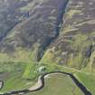
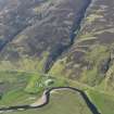
Craig Halligarry
Field System (Period Unassigned), Hut Circle(S) (Prehistoric), Track(S) (Period Unassigned)
Site Name Craig Halligarry
Classification Field System (Period Unassigned), Hut Circle(S) (Prehistoric), Track(S) (Period Unassigned)
Canmore ID 7183
Site Number NC92SW 25
NGR NC 923 202
NGR Description Centred NC 923 202
Datum OSGB36 - NGR
Permalink http://canmore.org.uk/site/7183
- Council Highland
- Parish Kildonan
- Former Region Highland
- Former District Sutherland
- Former County Sutherland
NC92SW 25 centred 923 202
(A: NC 9237 2029
B: NC 9240 2029, NC 9227 2036 & NC 9228 2035)
Hut Circles (NR).
OS 6" map, (1963).
A settlement of possibly four hut-circles accompanied by field clearance mounds. "The mounds are said to have been investigated for cists but nothing, has been found in them (J M Davidson 1940)".
Visited by OS (W D J) 3 June 1961
There are two hut-circles (A and B) and an associated field system in a high, fairly level situation open to the S. Of the features at NC 9227 2036 and NC 9228 2035 the first is natural; the second, a low circular band 1.0 m broad of heather-covered rubble enclosing a not particularly levelled area of 4.0 m diameter, is certainly not a hut. It may be a disturbed stone clearance heap.
The two huts are heather-covered and much reduced, and both have an entrance from the S.
'A' is 6.5 m diameter inside a wall spread to 1.5 m.
'B' is 7.5 m diameter internally; the wall is of indeterminate dimension.
The field system, about ten hectares in area, is mainly distinguished by stone clearance heaps, numerous along its E face but sporadic elsewhere. There are occasional obscure lynchets and in the S extent what appear to be one or two wasted field banks. Measureable cultivation plots are not discernible.
Revised at 1/10,000.
Visited by OS (J M), 7 December 1976.


