
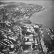
Greenock, James Watt Dock


Dock(S) (19th Century) - (20th Century)
Site Name Greenock, James Watt Dock
Classification Dock(S) (19th Century) - (20th Century)
Alternative Name(s) Garvel Point; Greenock Harbour; Upper Firth Of Clyde; Inner Clyde Estuary
Canmore ID 68371
Site Number NS27NE 17
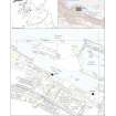
NGR NS 29677 75697
Datum OSGB36 - NGR
Permalink http://canmore.org.uk/site/68371


First 100 images shown. See the Collections panel (below) for a link to all digital images.
- Council Inverclyde
- Parish Greenock
- Former Region Strathclyde
- Former District Inverclyde
- Former County Renfrewshire
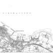
NS27NE 17.00 29677 75697
James Watt Dock [NAT]
OS 1:10,000 map, 1993.
Formerly entered as NS27NE 16 at cited location NS 296 757.
For (adjacent to NW) training school (NS 2959 7859), see NS27NE 12.
For (adjacent to S) sugar warehouse (NS 29828 75528), see NS27NE 15.
See also:
NS27NE 31.00 NS 29337 75925 Garvel Wet Dock
NS27NE 31.01 NS 29331 75888 Garvel Dry Dock
NS37NW 18.00 NS 30304 75600 Great Harbour
NMRS REFERENCE:
Architect: Walter R Kinipple 1886.
(Undated) information in NMRS.
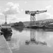
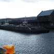
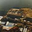
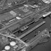
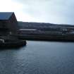
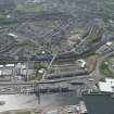
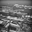
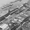
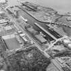
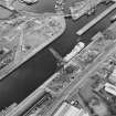
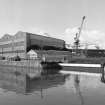
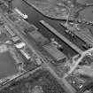
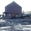
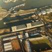
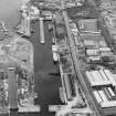
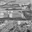
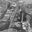
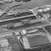
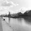
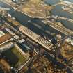
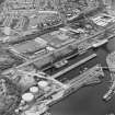
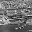
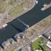
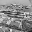
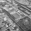
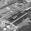
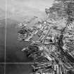
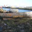
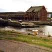
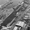
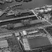
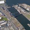
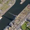
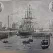
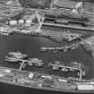
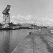
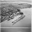
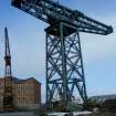
(Location cited as NS 297 757). James Watt Dock, 1879-86, engineer W R Kinipple. A roughly rectangular gated basin, with a short pier at the E end giving additional berthage.
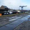
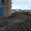
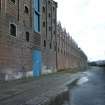
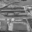
Along the S quay is a fine range of red- and white-brick warehouses [NS27NE 15], with two 5-storey and attic, 7-bay blocks, with central hoists, and two 3-storey and attic, one 9-bay, the other 11. The lower buildings have ridged roofs, with circular windows in the attics.
Immediately adjacent to the N are the Great Harbour (NS37NW 18.00), 1880 on, and the Garvel Graving Dock (1871), engineer W R Kinipple.
J R Hume 1976.
Visible on vertical air photographs (88/041/98, 100, flown 1988).
Information from RCAHMS (RJCM/DE) July 1996
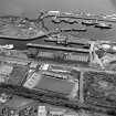
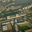
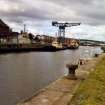
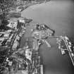
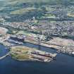
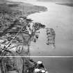
The James Watt Dock was Greenock's answer to Queen's Dock, Glasgow (NS56NE 88.00). Its 14.5 acre [5.9ha] area was intended to accommodate the largest vessels using the Clyde; 2133yds [1951m] of berthage was available. It was also to be the only true wet dock on the river, a minimum depth of 28ft [8.5m] being maintained by a sliding entrance-gate. The corresponding figure at Queen's Dock was only 20ft [6.1m].
The scheme was approved by the Greenock Harbour Trust in June 1878; the foundation stone was laid in August 1881 and the dock was opened in August 1886. Its cost had risen from an estimated £208,000 to over £850,000 on completion.
Trade to did not readily move to the dock, which remained consistently underused. It caused considerable embarrassment to the Greenock Harbour Trust, and was to be the last new work at Greenock for nearly 80 years.
J Riddell 2000.
Project (2007)
This project was undertaken to input site information listed in 'Civil engineering heritage: Scotland - Lowlands and Borders' by R Paxton and J Shipway, 2007.
Publication Account (2007)
Also on the Garvel estate, to the south of Garvel Docks, lies the the James Watt Dock, named after the town’s eminent son.
The first sod was cut on 1 August 1879, the foundation stone was laid on 6 August 1881 and the dock was opened in 1886. It is 2000 ft long, 400 ft wide and 32 ft deep at low water. It is now little used.
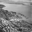
About the same time a massive river wall was built from Garvel Point to Inchgreen embracing the tidal harbours and bringing the total harbour accommodation of Greenock to more than 100 acres.
R Paxton and J Shipway
Reproduced from 'Civil Engineering heritage: Scotland - Lowlands and Borders' with kind permission of Thomas Telford Publishers.
Project (2008)
An impact assessment was undertaken by Headland Archaeology in 2008.
Headland Archaeology 2008
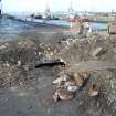
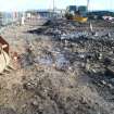
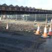
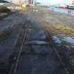
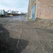
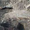
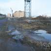
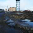
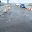
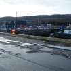
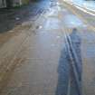
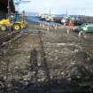
Watching Brief (March 2011 - August 2011)
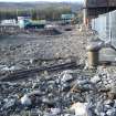
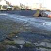
Headland Archaeology Ltd was commissioned by James Watt Dock LLP to undertake a programme of archaeological works in connection with a planning condition on public realm landscaping works at James Watt Dock, Greenock. The work included a ‘reactive watching brief’ where archaeological monitoring of groundbreaking works was undertaken where and when archaeological remains were uncovered during groundbreaking works or in areas of known archaeological sensitivity.
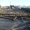
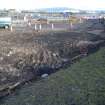
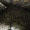
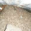
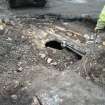
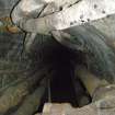
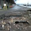
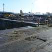
Headland responded to a single call-out during the reactive watching brief on ground breaking works in March 2011. This recorded a brick-constructed culvert that contained a number of cast-iron pipes and modern cables. The culvert was considered to be part of the original docks constructed in the 1870s.
Note (6 June 2017)
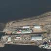
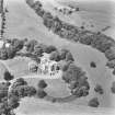
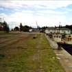
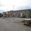
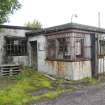
The building of the James Watt Dock (1878-86) was part of a scheme to improve the harbours of Greenock so that they could compete with the Glasgow dockyards. Garvel Park with its country house and estate sitting on a headland was mostly excavated away leaving only the former Georgian house remaining (see NS27NE 59). The harbour scheme was to be a wet dock with lock gates at both the W and NE entrances but it was never completed as planned. Only the James Watt Harbour and part of the Great Harbour (NS27NE 18) were completed. While the harbour still has some commercial activity the E half is now used as a marina.
Information from HES, Survey and Recording (AKK) 2 April 2017.

