
Myreside


Drain(S) (Period Unknown), Field Boundary (Period Unknown), Pit Enclosure (Prehistoric)(Possible), Ring Ditch (Period Unknown)
Site Name Myreside
Classification Drain(S) (Period Unknown), Field Boundary (Period Unknown), Pit Enclosure (Prehistoric)(Possible), Ring Ditch (Period Unknown)
Canmore ID 68164
Site Number NO14SE 54
NGR NO 170 443
NGR Description Centred on NO 1689 4423
Datum OSGB36 - NGR
Permalink http://canmore.org.uk/site/68164


- Council Perth And Kinross
- Parish Blairgowrie
- Former Region Tayside
- Former District Perth And Kinross
- Former County Perthshire
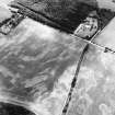
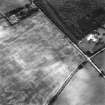
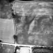
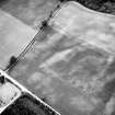
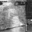
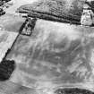
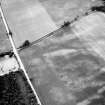
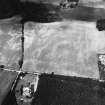
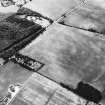
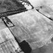
NO14SE 54 Centred on NO 1689 4423
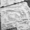
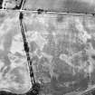
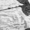
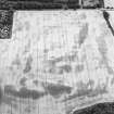
(Classified as ring-ditch and linear cropmarks).
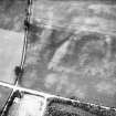
Scheduled as Myreside, ring-ditch and pit-alignment.
Information from Historic Scotland, scheduling document dated 13 February 2001.
Aerial Photographic Interpretation (27 January 1993)
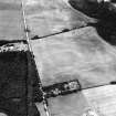
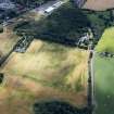
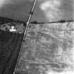
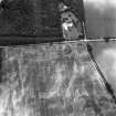
The cropmark of a ring-ditch has been revealed by aerial photography about 400m SSE of Myreside steading. It measures about 10m in internal diameter and there is probably an entrance on the SE. A linear cropmark, which extends across the field from E to W, is probably a former field-boundary; until recently this field was divided into four.
Information from RCAHMS (JRS) 27 January 1993

