
Windy Edge


Cairn(S) (Prehistoric)
Site Name Windy Edge
Classification Cairn(S) (Prehistoric)
Alternative Name(s) Tinnisburn Forest; Whisgills
Canmore ID 67907
Site Number NY48SW 6
NGR NY 4294 8389
NGR Description NY 4294 8389 and NY 4300 8388
Datum OSGB36 - NGR
Permalink http://canmore.org.uk/site/67907


- Council Dumfries And Galloway
- Parish Canonbie
- Former Region Dumfries And Galloway
- Former District Annandale And Eskdale
- Former County Dumfries-shire
NY48SW 6 4294 8389 and 4300 8388
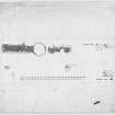
Two small cairns, 20 ft and 13 ft in diameter, lie 50 ft S of the W end of the main cairn, and 50 ft S of the E end of the smaller cairn (described on NY48SW 1). They are marked by grassy areas, a slight rise above the level, and some scattered stones.
RCAHMS 1920; A S Henshall 1972, visited 1956
The two low stony mounds were located in dense afforestation; both have been disturbed by deep ploughing and tree growth:
NY 4294 8389. 6.1m in diameter and up to 0.3m in height.
NY 4300 8388. 5.0m in diameter and up to 0.3m in height.
Neither mound can be positively identified as a burial cairn from the ground evidence.
Visited by OS (MJF) 1 August 1979
(Location cited as NY c. 429 838). Situated upon a hilltop now totally engulfed in coniferous forest. The RCAHMS have recorded two cairns, situated at each end of the long cairn NY48SW 1. They can just be identified under mature trees, but measurement is impossible and the figures of 20 ft (c. 7m) for the E cairn (ED 11) and 13 ft (c. 4m for the W cairn (ED 12) may be accepted.
M J Yates 1984.
Field Visit (4 June 1920)
Round cairns, Windy Edge.
Rather less than 50 feet south of either extremity [of the main cairn NY48SW 1] is the site of a round cairn, marked by a smooth grassy sward, a slight rise above the level, and some scattered stones. That on the east measures about 20 feet in diameter, and that on the west about 13 feet.
RCAHMS 1920, visited 4 June 1920.
Field Visit (February 1981)
Windy Edge (DMF 4) NY 42 83, 43 83 NY48SW 1, 6 & 7
(3) NY 429 838. This round cairn is situated 15m S of (1) and measures about 4m in diameter.
(4)NY 430 838. This round cairn is situated 21m SSW of (2) and measures about 6m in diameter. Both (3) and (4) have been disturbed during forestry operations.
RCAHMS 1981, visited February 1981
(Stat Acct, xvi, 1795, 85; RCAHMS 1920, pp. 28-30, No. 47; Henshall 1963-72, ii, 420-2)
Note (1997)
NY 4294 8389 and 4300 8288 NY48SW 6
These alleged cairns are situated in an area of forestry plantation which has recently been felled and replanted. Only the more westerly cairn, which has been disturbed by the construction of a drain, was identified on the date of visit.
Visited by RCAHMS (JRS, ARW), 16 March 1993.
Listed as cairns.
RCAHMS 1997

