
Stoneylea


Enclosure (Period Unknown), Field Boundary(S) (Period Unknown)
Site Name Stoneylea
Classification Enclosure (Period Unknown), Field Boundary(S) (Period Unknown)
Canmore ID 67560
Site Number NY37SW 17
NGR NY 31062 72616
Datum OSGB36 - NGR
Permalink http://canmore.org.uk/site/67560


- Council Dumfries And Galloway
- Parish Half Morton
- Former Region Dumfries And Galloway
- Former District Annandale And Eskdale
- Former County Dumfries-shire
Aerial Photographic Transcription (16 February 1993 - 1 March 1993)
An aerial transcription was produced from oblique aerial photographs. Information from Historic Environment Scotland (BM) 31 March 2017.
Aerial Photographic Interpretation (20 February 1996)
NY37SW 17 3106 7260
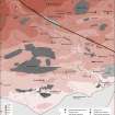
Air photography (RCAHMSAP 1984) has recorded the parchmarks of a ditched enclosure 200m E of Stoneylea steading (NY37SW 38). Subrectangular on plan, but with slightly bowed sides, it measures about 45m from NE to SW by 25m transversely within a ditch 2m in breadth. Traces of other lengths of ditch on the NE and at the W angle may indicate the presence of an annexe or another enclosure.
Information from RCAHMS (SPH), 20 February 1996.
Listed as (rectilinear) enclosure.
RCAHMS 1997.
Aerial Photographic Transcription (5 November 2012)
An interpretative transcription, or mapping, of information on oblique aerial photographs was produced on 05 November 2012.

