
South Woodfoot


Enclosure (Period Unknown), Field Boundary(S) (Period Unknown)
Site Name South Woodfoot
Classification Enclosure (Period Unknown), Field Boundary(S) (Period Unknown)
Alternative Name(s) Raeburnfoot, Gretna
Canmore ID 67556
Site Number NY37SW 13
NGR NY 30388 71951
Datum OSGB36 - NGR
Permalink http://canmore.org.uk/site/67556


- Council Dumfries And Galloway
- Parish Half Morton
- Former Region Dumfries And Galloway
- Former District Annandale And Eskdale
- Former County Dumfries-shire
Aerial Photographic Transcription (16 February 1993 - 2 March 1993)
An aerial transcription was produced from oblique aerial photographs. Information from Historic Environment Scotland (BM) 31 March 2017.
Aerial Photographic Interpretation (20 February 1996)
NY 3037 7195 NY37SW 13
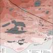
Air photography (RCAHMSAP 1984) has recorded the cropmarks of what may be the remains of a large enclosure on the N side of a stream gully 600m WSW of South Woodfoot steading (NY37SW 50). Apparently enclosing an area measuring about 155m from NW to SE by 110m internally, the ditch pursues an irregular course, particularly on the E where it is possible that the perimeter incorporates part of an old stream channel.
The boundary-ditches visible on the photographs in the fields on the opposite side of the gully to the S probably belong to a system of ditches recorded in the vicinity of the settlement and field-system at Raeburnfoot (NY37SW 12).
Information from RCAHMS (SPH), 20 February 1996.
Raeburnfoot, Gretna. Listed as enclosure (possible) and ditch-system (with NY37SW 12).
RCAHMS 1997.
Aerial Photographic Transcription (5 November 2012)
An interpretative transcription, or mapping, of information on oblique aerial photographs was produced on 5 November 2012.

