|
Prints and Drawings |
DC 32153 |
Records of the Royal Commission on the Ancient and Historical Monuments of Scotland (RCAHMS), Edinbu |
Solway Plain landscape case-study area: map showing the main medieval monuments, the extent of cultivation in about 1750, and areas of bogs and wetlands. Published in Eastern Dumfriesshire: an archaeological landscape. |
1996 |
Item Level |
|
|
All Other |
G 94604 PO |
|
Mechanical copy of drawing showing sketch view. |
14/10/1823 |
Item Level |
|
|
All Other |
G 94605 PO |
|
Cutting. View from S. |
28/6/1984 |
Item Level |
|
|
All Other |
G 94606 PO |
|
Cutting. View from SE. |
12/7/1984 |
Item Level |
|
|
All Other |
G 94607 PO |
|
Cutting. View from S. |
13/10/1983 |
Item Level |
|
|
Prints and Drawings |
DFD 92/1 |
Records of the Royal Commission on the Ancient and Historical Monuments of Scotland (RCAHMS), Edinbu |
Plan. |
1912 |
Item Level |
|
|
Manuscripts |
MS 2009/9 |
Papers of Roger J Mercer, archaeologist, Edinburgh, Scotland |
Kirkpatrick Fleming Field Survey Building Record Forms. Area 9. |
1988 |
Item Level |
|
|
Photographs and Off-line Digital Images |
G 96655 PC |
Papers of Roger J Mercer, archaeologist, Edinburgh, Scotland |
View from W. |
1988 |
Item Level |
|
|
Photographs and Off-line Digital Images |
G 96656 PC |
Papers of Roger J Mercer, archaeologist, Edinburgh, Scotland |
View from W. |
1988 |
Item Level |
|
|
Photographs and Off-line Digital Images |
G 96657 PC |
Papers of Roger J Mercer, archaeologist, Edinburgh, Scotland |
View from W. |
1988 |
Item Level |
|
|
Photographs and Off-line Digital Images |
G 96658 PC |
Papers of Roger J Mercer, archaeologist, Edinburgh, Scotland |
View from SW. |
1988 |
Item Level |
|
|
Photographs and Off-line Digital Images |
G 97171 CS |
Papers of Roger J Mercer, archaeologist, Edinburgh, Scotland |
Photographic copy of drawing showing general view. |
|
Item Level |
|
|
Prints and Drawings |
DC 15531 |
|
Drawing by Willlam Graham of Mossknow in 1823. |
14/10/1823 |
Item Level |
|
|
Prints and Drawings |
BD 61/10 |
Papers of Roger J Mercer, archaeologist, Edinburgh, Scotland |
Ground plan of the tower. #311 |
10/4/1989 |
Item Level |
|
 |
On-line Digital Images |
DP 107885 |
RCAHMS Aerial Photography Digital |
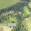
General oblique aerial view of Robgill Tower and policies, taken from the SE. |
3/8/2011 |
Item Level |
|
 |
On-line Digital Images |
DP 107886 |
RCAHMS Aerial Photography Digital |
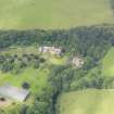
General oblique aerial view of Robgill Tower and policies, taken from the ESE. |
3/8/2011 |
Item Level |
|
 |
On-line Digital Images |
DP 107888 |
RCAHMS Aerial Photography Digital |
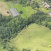
Oblique aerial view of Robgill Tower and Woodhouse Tower, taken from the ENE. |
3/8/2011 |
Item Level |
|
 |
On-line Digital Images |
DP 107889 |
RCAHMS Aerial Photography Digital |
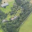
Oblique aerial view of Robgill Tower and policies, taken from the NNW. |
3/8/2011 |
Item Level |
|
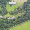 |
On-line Digital Images |
DP 107890 |
RCAHMS Aerial Photography Digital |
Oblique aerial view of Robgill Tower and policies, taken from the NW. |
3/8/2011 |
Item Level |
|
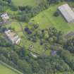 |
On-line Digital Images |
DP 107891 |
RCAHMS Aerial Photography Digital |
Oblique aerial view of Robgill Tower and policies, taken from the WSW. |
3/8/2011 |
Item Level |
|
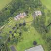 |
On-line Digital Images |
DP 107892 |
RCAHMS Aerial Photography Digital |
Oblique aerial view of Robgill Tower and policies, taken from the SSE. |
3/8/2011 |
Item Level |
|
|
Manuscripts |
MS 36/49 |
Records of the Royal Commission on the Ancient and Historical Monuments of Scotland (RCAHMS), Edinbu |
Field notebook of A L MacGibbon ? (RCAHMS): Dumfriesshire. Includes measured sketches. |
10/6/1910 |
Item Level |
|
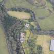 |
On-line Digital Images |
DP 271080 |
Historic Environment Scotland |
Oblique aerial view. |
22/2/2018 |
Item Level |
|
|
Digital Files (Non-image) |
GV 007428 |
Records of the Royal Commission on the Ancient and Historical Monuments of Scotland (RCAHMS), Edinbu |
Solway Plain landscape case-study area: map showing the main medieval monuments, the extent of cultivation in about 1750, and areas of bogs and wetlands. Published in Eastern Dumfriesshire: an archaeological landscape. |
1996 |
Item Level |
|


