
Kirkpatrick-fleming


Temporary Camp(S) (Roman)
Site Name Kirkpatrick-fleming
Classification Temporary Camp(S) (Roman)
Canmore ID 67135
Site Number NY27SE 7
NGR NY 28060 70200
NGR Description From NY 2806 7020 to NY 2785 7020
Datum OSGB36 - NGR
Permalink http://canmore.org.uk/site/67135


- Council Dumfries And Galloway
- Parish Kirkpatrick-fleming
- Former Region Dumfries And Galloway
- Former District Annandale And Eskdale
- Former County Dumfries-shire
NY27SE 7 2806 7020 to 2785 7020.
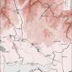
(Centred NY 280 702) A Roman temporary camp, the largest yet seen in the area, c. 2,000' E-W by 1.375', is visible on APs. Within the W half is a second camp on a slightly different alignment, some 900' by 675'. A W gate only has been noted so far. APs show several sections of straight sided ditch, rounded angles, etc.
J K St Joseph 1951; 1958; 1961
Larger camp centred NY 2806 7020; smaller camp centred NY 2785 7020. No trace of either of these camps is visible on the ground.
Surveyed at 1/2500 from St. Joseph APs/ground control.
Visited by OS (WDJ) 17 October 1967
A large portion of this camp was destroyed by road works in 1968. An excavation was carried out to obtain a plan of the ditch of the parts threatened, not visible on APs. The ditch was 4' wide and 3' deep, but could not be located in the SE side in the time available as it lay in a thick wood much disturbed by drainage works. No small finds were made.
A Gibbs 1968
63-acre Severan camp.
J K St Joseph 1969
In advance of proposed upgrading of the A74(T) to motorway standard, APG were requested by Historic Scotland to undertake geophysical survey and excavation of part of a large marching camp situated on the outskirts of the village of Kirkpatrick Fleming. Discovered during aerial reconnaissance by CUCAP some forty years ago, the site falls into JKS St Joseph's putatively Severan '63 acre series', though its location in the far south-west of Scotland distances it considerably from other known examples of this 'type'. Work took place over three weeks in August 1990 and concentrated upon the eastern quarter of the camp, lying in fields set between the A74(T) and the railway line.
The geophysical survey element was undertaken along a transect 40-60m wide, overlying and immediately within the NE ditch of the camp, covering a total area of 12,000 square metres. This was carried out prior to excavation and succeeded in locating the camp ditches as well as revealing a number of anomalies from within the camp perimeter. Selected areas were then stripped of topsoil by machine, a total of 1,350 square metres in all, revealing stretches of both NE (70m) and SE (40m) ditches as well as uncovering areas over the four principle geophysical anomalies.
A gap in the NE ditch was uncovered within the stretch stripped by machine; a little over 15 metres wide it presumably denotes the location of a gateway. Despite a systematic search there was no trace of a clavicula or oblique traverse; a titulum is the most likely form of gate protection, although any such device will have been destroyed by the 19th century railway cutting. The camp ditch had dimensions of c2.9m wide and c0.55m deep to east of the entrance gap, c1.95m wide and c0.7m deep to the west. No gate was located on the SE side; it must lie to south of the area investigated, probably beneath the current A74. The ditch dimensions here measured c2.15m wide and 0.65m deep. At no point on either of the twosides was rampart material found to survive in situ. On investigation none of the selected geophysical anomalies transpired to represent features of any great antiquity. Two related to old field boundaries, the third to a modern pipeline and the fourth perhaps to a piece of buried metal.
There were no finds of any antiquity from any of the excavated areas.
Although no positive evidence existed for the presence of an annexe to the 63-acre marching camp, comparable features have been detected at eight other members of the 'series'; the possibility of a similar feature existing at Kirkpatrick Fleming therefore seemed quite high. A ditch, commensurate with that of an annexe to the large marching camp, was found in the field, some 110 metres north of the 63 acre works' SW angle. This was traced for c55 metres, at first following an east-west alignbment, then curving round to the north. The impression created is that parts of the west and south sides, together with the south-west angle, of an annexe are represented.
Three sections were placed across the ditch, one of them pproducing five sherds of a Roman grey coarse ware jar, securely stratified in the lowest fill. Ditch dimensions varied in the three portions investigated, but the best mean estimate would be c1.50 metres wide and c0.70 metres deep. Siltinng platforms recovered from all three sections suggest that the ditch had been allowed to fill up naturally. No trace of a surviving accompanying rampart was recovered, nor was there any trace of turf in the make-up of the fill.
The presence of a newly constructed road, running east-west through the middle of the field, prohibited following the annexe ditch further. From the space available, the west side cannot have exceeded 50 metres in total length. The north and south sides must be of the order of 50-60 metres long. A trench employed to locate the junction point between the putative south side of the annexe and the west side of the large marching camp failed to locate either the junction point or the annexe ditch. This may represent some form of entrance gap.
The evidence recovered at Kirkpatrick Fleming is in no way absolute. The ditch recovered, while clearly Roman, does not unequivocally belong to a marchinng camp annexe, though this would appear to be the most likely explanation of its function. It is possible that it represents part of an unfinished annexe, or part of a third, necessarily small, camp, or simply a length of ditch of unknown purpose.
Sponsors: SDD (Roads); Shanks and McEwan (Contractors) Ltd.
A F Leslie 1991
NY 278 704. The condition of the ditches forming the N angle of the larger Roman temporary camp was uncertain following disturbance of the area during construction of the A74 dual carriageway in 1968. Small scale development in the area was subject to watching briefs which were successful in showing that the NE ditch survives around NY 2786 7048. The N angle was not however located.
Details in Dumfries and Galloway SMR and copied to NMRS.
Sponsor: Dumfries and Galloway Regional Council
J Braan 1995
A 1993 watching brief located the V-shaped NE defensive ditch, 2m wide and 0.75m deep, of the larger of the two camps. Further work in 1995 in the vicinity of the N corner was inconclusive.
L J F Keppie 1996.
NY 279 703 Excavation of foundations for a garage, within the perimeter of the Roman camp (NMRS NY27SE 7), revealed a dark, humic soil with 19th-century material.
Sponsor: Dumfries and Galloway Council.
A Nicholson 2000
Aerial Photographic Transcription (6 December 1996 - 17 December 1996)
An aerial transcription was produced from oblique aerial photographs. Information from Historic Environment Scotland (BM) 31 March 2017.
Note (1997)
NY 2806 7020 NY27SE 7
Listed as temporary camps (2) and enclosure.
RCAHMS 1997.
Publication Account (17 December 2011)
The two (possibly three) camps at Kirkpatrick-Fleming lie on a low rise on the Roman road into south-west Scotland and are now cut by the main road (A74(M)) and railway lines into this area. The first was discovered in 1949 through cropmarks by St Joseph from the air (1951a: 57); the second, which lies wholly within the western part of the first at an oblique angle, was subsequently recorded in 1958 (St Joseph 1961: 122).
Camp I measures just over 600m from WNW to ESE by 420m transversely, enclosing 24.5ha (just over 60 acres). An entrance gap has been excavated on the NNE side, but no accompanying entrance protection has been recorded. Various excavations, watching briefs and a geophysical survey have been carried out on parts of the camp in advance of the upgrade of the A74 road to motorway status. These have recorded that the ditch of the camp measured up to 2.9m in width and 0.75m in depth in places (Leslie 1991; Keppie 1996a: 402). The excavations revealed the remains of a possible road, also suggested by a snow line, which may be Roman, although insufficient dating evidence was recovered. In addition, parts of a possible annexe or third camp were located to the west of camp I (Kirkpatrick- Fleming III ) (Leslie forthcoming). This structure runs to the north-west of camp I for about 55m before turning to the north in a slightly rounded corner angle. The ditch was V-shaped, measuring up to 1.7m in width and 0.7m in depth in places. One section contained five sherds of pottery from the same Roman grey coarseware in the silt at the bottom of the ditch (Leslie 1991). This pottery has been dated to ad 100–150 (A Leslie pers comm). If this is indeed an annexe, as seems likely, it would have met the putative Roman road some 45m to the north. If its dimensions were 55m by 45m then it would have been very small, at 0.25ha (0.6 acres), but its relationship with the possible road is unknown.
Camp II lies within camp I, but the two do not appear to share any common sides. It measures 265m from northwest to south-east by 211m, enclosing almost 5.5ha (13.5 acres). An entrance gap protected by a titulus is visible on the south-west side, towards its western end. Unlike camp I, this camp has not been subject to excavations, lying a short distance away from the main road.
R H Jones.
Aerial Photographic Transcription (7 November 2012)
An interpretative transcription, or mapping, of information on oblique aerial photographs was produced on 7 November 2012.
Aerial Photographic Transcription (6 November 2012)
An interpretative transcription, or mapping, of information on oblique aerial photographs was produced on 6 November 2012.

