Scheduled Maintenance
Please be advised that this website will undergo scheduled maintenance on the following dates: •
Tuesday 3rd December 11:00-15:00
During these times, some services may be temporarily unavailable. We apologise for any inconvenience this may cause.
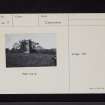
Woodhouse Tower
Barmkin (Medieval), Tower House (Medieval)
Site Name Woodhouse Tower
Classification Barmkin (Medieval), Tower House (Medieval)
Alternative Name(s) Wardhouse Tower
Canmore ID 67133
Site Number NY27SE 5
NGR NY 25071 71497
Datum OSGB36 - NGR
Permalink http://canmore.org.uk/site/67133
- Council Dumfries And Galloway
- Parish Kirkpatrick-fleming
- Former Region Dumfries And Galloway
- Former District Annandale And Eskdale
- Former County Dumfries-shire
NY27SE 5 25071 71497
(NY 2507 7149) Woodhouse Tower (NR) (Remains of)
OS 6" map (1957).
(Tower-house of the Fourth Period). The tower-houses of Bonshaw (NY27SW 6.00), Robgill (NY27SW 7.00) and Wardhouse/Woodhouse are all situated in the same locality, and within one mile of each other, being in the parish of Annan and from four to five miles distant from the town of that name. They stand in a singularly beautiful valley, through which runs the Kirtle Water. Of the three towers, only Bonshaw is anything like perfect, the other two having had very rough usage. They have all evidently been built about the same time and have many points of resemblance to each other. They are within a few feet of the same size, the average dimensions being about 34 ft (10.4m) by 25 ft (7.6m). Bonshaw is slightly the largest. Bonshaw and Robgill have each a splayed base, and the entrance doorway and staircase are alike in both. The mode in which Robgill was finished at the top cannot now be positively ascertained, but the other two towers were almost identical in the corbelling and parapet, and both have splayed shot-holes and the same small high window on the ground floor. In each case the ground floor only is vaulted.
Wardhouse is situated on the banks of the Kirtle, almost opposite Ribgill, but only on the ground floor is the outline of the tower entire. Some years ago the building fell, through neglect and decay, but was immediately re-erected as see it now. The staircase is narrower than in the other towers, and is situated in the corner opposite the door. The upper floor windows are about 2 ft (0.6m) square, placed in the centre of arched recesses. Only one side of the hall fireplace remains; it has been large and good. This tower has been a storey higher than its neighbours at Bonshaw and Robgill.
D MacGibbon and T Ross 1887-92.
The restored N wall with its return at each angle and the grass-grown foundations of the S, and parts of the E and W walls remain. Some 32 ft. by 24 ft. 6 in. overall, the walls 5 ft. thick. Very similar to the 16th c towers at Bonhaw (NY27SW 6) and Robgill (NY27SW 7).
RCAHMS 1920
Woodhouse Tower, restored 1877, is as described by RCAHMS. A newel stairway is in the NE angle. There are traces of a courtyard wall on all four sides.
Revised at 25".
Visited by OS (WDJ) 18 October 1967
No change to previous field report.
Visited by OS (IA) 21 February 1973.
Scheduled as 'Woodhouse Tower... the remains of... a late 16th-century tower house, sited in a commanding position on the escarpment east of the Kirtle Water.'
Information from Historic Scotland, scheduling document dated 22 January 2008.
Description:
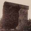
Probably 16th century. Surviving full-height N wall and returns of ruinous tower house. Rubble-built ashlar dressings. Gun port at ground; corbelled parapet; wheel stair (steps broken) within NE angle.
Notes:
Stabilised 1877 (inscribed stone).
References:
RCAHM INVENTORY 1920 No 368.
Listed B 3 August 1971
De-listed May 2008
(Undated) information from Historic Scotland.
Field Visit (14 October 1993)
NY 2507 7149 NY27SE 5
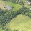
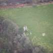
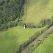
The imposing remains of this late 16th-century tower-house occupy a commanding position on the escarpment to the E of the Kirtle Water and in sight of Robgill Tower (NY27SW 7). The surviving fragment comprises the NE wall (to wall-head height) and parts of the adjoining NW and SE walls, the latter, together with the greater part of the NE wall, having been restored in 1877. Fragmentary turf-covered foundations of the corresponding SW wall indicate that the tower was rectangular on plan, measuring 9.6m from NW to SE by 7m transversely over wall up to 1.7m thick at ground-floor level. The tower originally stood to a height of three storeys and an attic.
The entrance was probably at the W end of the SW wall, where there is a surviving jamb, checked internally and wrought with a quirked roll-and-hollow moulding and fact, stopped with a splay. A newel-stair, accommodated in a stair-well in the E angle of the tower, may have been contrived as part of the 1877 restoration to allow access to the wall-head. The stair-treads have been almost entirely removed, only the stubs remaining. Two slit-windows in the SE wall, lighting the stair, are square-arrised and clearly date from the restoration. The wall-head carries a two-strand corbel table with a rolled sill and cyma-recta moulded cornice, apparently for a continuous parapet of slight projection. The NW wall terminates on the N with a plain-coped gable for a garret.
The basement was vaulted, although only a portion of the springing in the NE wall remains, providing the clearest indication of the extent of the 1877 restoration; it was lit by a wide-mouthed horizontal gunloop set central to each wall. A vertical window with a stepped sill is set beneath the projected soffit of the vault and may indicate the former presence of an entresol, or a wish to provide additional light.
At first-floor level, in the NW wall, there is the ingo, with aumbry (salt-box) and roll-moulded jamb, for the hall fireplace, and, beside it, an aumbry checked for a wooden frame and door. In a corresponding position in the NE wall, there is a window embrasure with segmental lead and ashlar rear-arch, cut-back window seats, and an aumbry in the ingo. The window itself, originally barred and checked for a fixed frame, has a stout roll-moulded arris. Two corbels in the NE wall, together with a projecting jamb for a fireplace in the NW wall, indicate the position of the joisted timber floor at second-floor level. On this floor, the only surviving features are an aumbry in the NW wall, and a window embrasure, with a semental head, in the NE wall. Externally, this window, too, has a stout edge roll. A solitary corbel towards the N end of the NE wall indicates the floor-level of the garret; the fireplace in the NW wall has a plain ashlar jamb.
On the WSW side of the tower, and extending along the edge of the escarpment, there are the turf-covered footings of the barmkin wall. This returned some 15m to the SW of the tower, being here represented by a turf-covered stony bank spread up to 2.5m thick and 0.6m high. A shallow rectangular depression within the angle of the barmkin may indicate the presence of an outbuilding measuring about 9.6m by 6m overall.
Visited by RCAHMS (IMS), 14 October 1993.
Listed as tower.
RCAHMS 1997.


