
Learable


Cup Marked Stone (Neolithic) - (Bronze Age)
Site Name Learable
Classification Cup Marked Stone (Neolithic) - (Bronze Age)
Canmore ID 6709
Site Number NC82SE 2
NGR NC 89491 24005
Datum OSGB36 - NGR
Permalink http://canmore.org.uk/site/6709


- Council Highland
- Parish Kildonan
- Former Region Highland
- Former District Sutherland
- Former County Sutherland
Field Visit (29 May 1961)
NC82SE 2 8948 2400.
(NC 8948 2400) Cup-marked Stone (NR)
OS 6"map, (1962)
A cup-marked, earth-fast boulder of schist with a flat upper surface exposed for an area of 7' by 3'4". The cup-marks, well-defined and measuring about 3 1/2" in diameter by 1 1/2" deep, occur in two groups, one at the SW end of the stone consisting of twelve orthodox cup-marks and an elongated marking and the other group near the middle of the stone consisting of seven small cup-marks and two elongated markings. The three elongated markings measure 6" to 7" in length and may be due to weathering combining pairs of round cup-marks.
Visited by OS (W D J) 29 May 1961
(RCAHMS 1911, visited 1909)
Field Visit (23 December 1976)
No change to previous reports.
Visited by OS (J B) 23 December 1976
Field Visit (6 June 1991)
This cup-marked stone lies some 30m SSW of a cairn (NC82SE 3), immediately within the head-dyke of Learable township (NC82SE20). There are at least 16 plain cup-marks on its upper face (2m in length by 1.4m in breadth) and they measure up to 100mm in diameter and 40mm in depth.
Visited by RCAHMS (PJD) 6 June 1991.
Note (24 October 2019)
Date Fieldwork Started: 24/10/2019
Compiled by: NOSAS
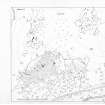
Location Notes: The panel lies on a S and SE facing open grass/moorland area overlooking the multi-period landscape of Learable, and Strath Kildonan beyond. It is about 12m S of a substantial stone and earth bank, and 25m SW of the W most tree. The panel Learable Hill (Canmore 6717, ScRAP 267) and stone circle is 40m to the NNE, and a clearance cairn lies about 30m NNE.
Panel Notes: The panel is a flat-topped oval boulder of gneiss 2.1 x 1.2m with a maximum height of 0.8m. The top (carved surface) slopes gently to the SE, and the ground falls away to the S, leaving a pronounced overhang. The carved surface is weathered and cracked. There are 20 cups, all in the S half of the panel, and two elongated 'cups' on the SE edge which respect the grain of the rock and may be natural.

