
Kinbrace Hill


Long Cairn (Neolithic)
Site Name Kinbrace Hill
Classification Long Cairn (Neolithic)
Alternative Name(s) Kinbrace Farm; Achentoul Forest
Canmore ID 6658
Site Number NC82NE 3
NGR NC 8717 2915
Datum OSGB36 - NGR
Permalink http://canmore.org.uk/site/6658


- Council Highland
- Parish Kildonan
- Former Region Highland
- Former District Sutherland
- Former County Sutherland
NC82NE 3 8717 2915.
(NC 8717 2915) Chambered Cairn (NR).
OS 6" map, 1962.
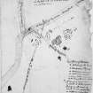
Two cairns of bare stone, apparently intact, forming an embryo long cairn, a two-phase monument of considerable interest in the development of the long cairn since it consists of a 'head' and 'tail', laid out in relation to each other, on the same axis, but set back to back and 9' apart.
The earlier of the two cairns is that on the NE which is almost square with rounded corners and rises steeply to a height of 14'. It measures about 100' along its main axis, and a low horn projecting about 7' on the north is clearly visible. A similar horn probably exists below the peat at the east corner.
The SW cairn is about 10' high, 102' long, 62' wide at the SW end and 36' wide at the NE end. There are ancient enclosures immediately to the south and east of the cairns but they are now hardly discernible under a thick growth of heather.
A S Henshall 1963, visited 1957, A S Henshall 1972, visited 1967.
Visited by OS (EGC) 26 May 1961
These cairns are as described by Henshall. There is no trace of chambers in either, though the NE example would almost certainly be chambered. Whether these cairns are contemporary or not, cannot be determined from ground inspection. A low spread bank 2.0 m wide and 0.2 m high runs from the SE corner of the SW cairn, and joins the NE cairn at its SE corner. A low stone and turf foundation 1.0m wide and 0.1m high connects the two on the NW side. These walls are of uncertain purpose and date. No "ancient enclosures" can be seen nearby; the cairns are now in a clearing within a forestry plantation.
Revised at 1/10,000.
Visited by OS (E G C) 26 May 1961
Field Visit (31 July 1991)
A spectacular cairn in two parts occupies a large forestry plantation in what was formerly open moorland on the E side of the Strath of Kildonan. The long axis of the monument is NE-SW with a massive cairn of bare stones forming the NE end and a long cairn of bare stones forming the SW end. The former measures some 28,1m from NE-SW and 23,5m transversely; it is about 3,2m in height from the NE side. There is a distinct stubby horn at the N corner. There is a track between the two parts of the cairn and there is now no trace of any intervening cairn material. The SW part of the cairn is at least 31m long and measures 17m in breadth at the SW end, 8.7m in breadth at the NE end and is at least 3m in
height.
Visited by RCAHMS (JNGR and DCC) 31 July 1991

