
Lochmaben


Pit(S) (Period Unknown), Temporary Camp (Roman)
Site Name Lochmaben
Classification Pit(S) (Period Unknown), Temporary Camp (Roman)
Alternative Name(s) Innerfield; Castle Loch; Halleaths Loch
Canmore ID 66286
Site Number NY08SE 28
NGR NY 09161 82270
Datum OSGB36 - NGR
Permalink http://canmore.org.uk/site/66286


- Council Dumfries And Galloway
- Parish Lochmaben
- Former Region Dumfries And Galloway
- Former District Annandale And Eskdale
- Former County Dumfries-shire
NY08SE 28 092 823.
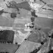
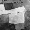
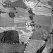
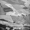
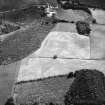
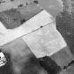
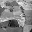
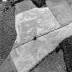
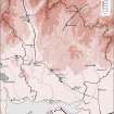
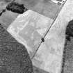
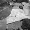
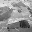
Trenching has established the whole of the N side, c. 518m long, and the NW angle of this camp, discovered from the air in 1967. Cropmarks confirmed by trenches at two points show that the E side was not less that 472m. The camp encloses the whole of a small hill between Castle Loch to the S and the former Halleaths Loch, drained in 1846, to the N; the dimension cannot exceed 495m because of the proximity of Castle Loch. A camp of 25.5ha would lie symmetrically on the hill and closely match is size and proportions the camp of 25.2ha at Dalswinton, 17km to the W.
(Information from J K St Joseph.)
J K St Joseph 1969; S S Frere 1986.
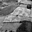
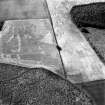
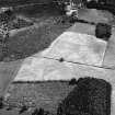
Nothing visible on the ground.
Visited by OS, 5 June 1975.
Note (1997)
NY 092 823 NY08SE 28
Listed as temporary camp.
RCAHMS 1997.
Publication Account (17 December 2011)
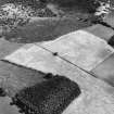
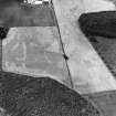
Discovered in 1967 by St Joseph from the air, this camp lies on level ground above Castle Loch, just west of the River Annan, some 2km west of the Roman fort at Ladyward and close to the line of the Roman road from Annandale towards the River Nith. Parts of three sides have been recorded through cropmarks, with trenching by St Joseph in 1985 recording the remainder of the north-east side together with the north corner angle (RCAHMS St Joseph Collection: DC 39372; depicted as a dashed line on illus 168). These reveal that the camp measured just over 500m from north-west to south-east by 465m transversely and enclosed 22.8ha (just over 56 acres). Possible entrance gaps are visible in the north-east and south-east sides. Drawings of sections of excavated ditch held by RCAHMS indicate that on the north side it was V-shaped, about 1.5m wide and 0.6m deep (RCAHMS St Joseph Collection: DC 39373).
R H Jones.
Aerial Photographic Transcription (16 July 2012)
An interpretative transcription, or mapping, of information on oblique aerial photographs was produced on 16 July 2012.

