
Dalswinton, Bankhead


Roman Fort(S) (Roman)
Site Name Dalswinton, Bankhead
Classification Roman Fort(S) (Roman)
Canmore ID 65893
Site Number NX98SW 10
NGR NX 93310 84850
Datum OSGB36 - NGR
Permalink http://canmore.org.uk/site/65893


First 100 images shown. See the Collections panel (below) for a link to all digital images.
- Council Dumfries And Galloway
- Parish Kirkmahoe
- Former Region Dumfries And Galloway
- Former District Nithsdale
- Former County Dumfries-shire
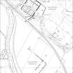
NX98SW 10 9331 8485
See also NX98SW 35.
(Centred: NX 9331 8485) Camp (R) (Site of)
OS 6" map (1948)
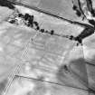
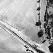
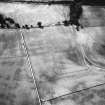
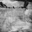
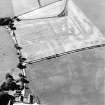
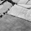
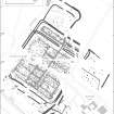
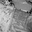
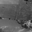
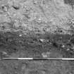
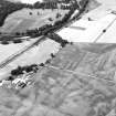
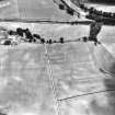
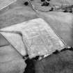
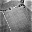
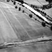
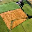
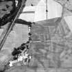
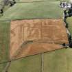
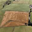
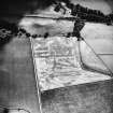
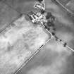
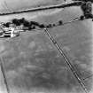
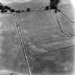
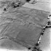
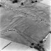
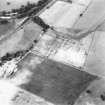
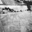
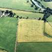
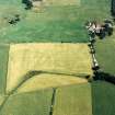
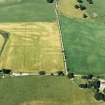
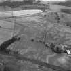
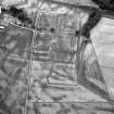
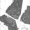
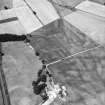
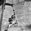
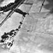
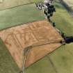
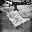
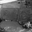
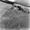
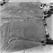
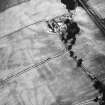
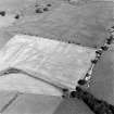
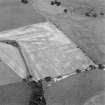
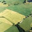
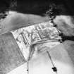
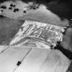
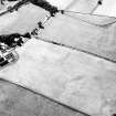
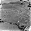
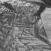
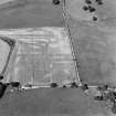
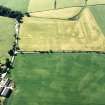
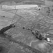
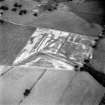
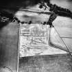
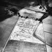
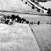
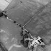
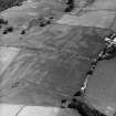
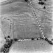
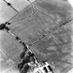
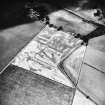
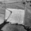
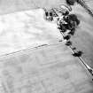
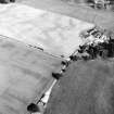
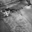
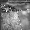
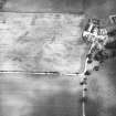
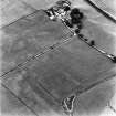
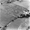
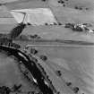
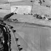
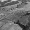
Two almost exactly superimposed Flavian forts, each with an annexe attached to its N rampart, were revealed by air photography, and subsequently excavated.
The earlier, and smaller of the two, about 600' square, was succeeded by the other, about 600 by 770', without any apparent break in the occupation of the site.
The later fort had another annexe on the SE, and a broad ditch extending from the S angle down a steep slope, below the fort, and may have enclosed another annexe on the SW side. Both forts are of a size to have held cavalry units and the later fort may have quartered the Ala Petriana.
J K St Joseph 1951, 1955; I A Richmond and J K St Joseph 1957; E Birley 1958
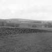
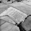
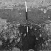
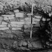
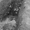
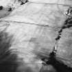
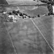
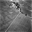
There are no surface indications of these sites, fields all having been cultivated. The finds from the excavations are on display in Dumfries Museum.
Visited by OS (RDL) 25 June 1964
Photographed by the RCAHMS 1984 and 1988.
(Undated) information in NMRS.
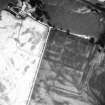
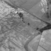
Magnetometry (June 2009)
NX 9331 8485 Magnetic survey of the north-western part of the Roman fort in June 2009 revealed details of the two superimposed forts and the northern annexe. Buildings and other structures were recorded.
Archive: RCAHMS (intended)
Funder: Deutsches Archäologisches Institut
C-M Hüssen, Rebecca Jones and WS Hanson – Römisch-Germanische Kommission (RGK)/RCAHMS, Glasgow University
Geophysical Survey (September 2009)
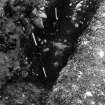
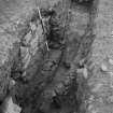
NX 9331 8485 Magnetic survey of most of the interior of the two (superimposed) forts, the northern annexe and much of the SE annexe in September 2009 proved informative. There was particularly good detail in the southern part of the fort and its immediate exterior on the slope down to the River Nith. While the northern annexe appeared rather sterile, several features were apparent in the other annexe including at least one thermoremanent structure, which accords well with Richmond and St Joseph’s discovery of a lead melting furnace in that area.
Richard Jones – Glasgow University
Aerial Photographic Transcription (9 May 2012 - 24 May 2012)

