Pricing Change
New pricing for orders of material from this site will come into place shortly. Charges for supply of digital images, digitisation on demand, prints and licensing will be altered.
Holywood
Field Boundary (Period Unassigned), Rig And Furrow (Medieval) - (Post Medieval)
Site Name Holywood
Classification Field Boundary (Period Unassigned), Rig And Furrow (Medieval) - (Post Medieval)
Canmore ID 65879
Site Number NX98SE 68
NGR NX 95130 80220
NGR Description From NX 9509 8009 to NX 9516 8033
Datum OSGB36 - NGR
Permalink http://canmore.org.uk/site/65879
- Council Dumfries And Galloway
- Parish Holywood
- Former Region Dumfries And Galloway
- Former District Nithsdale
- Former County Dumfries-shire
NX98SE 68 951 803 to 950 801
See also NX98SE 42 and NX98SE 44.
Scheduled (with NX98SE 44 and NX98SE 68 ) as 'Holywood, cursus, linear earthwork, pit alignment and enclosures'.
Information from Historic Scotland, scheduling document dated 8 September 2003.
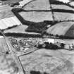
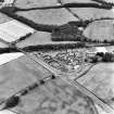
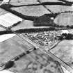
A field boundary and a block of rig have been recorded as cropmarks (RCAHMSAP 1984) to the E of the cursus monument (NX98SE 42).
Information from RCAHMS (BN) 29 April 2008
Aerial Photographic Transcription (15 November 1990 - 12 December 1990)
An aerial transcription was produced from oblique aerial photographs. Information from Historic Environment Scotland (BM) 31 March 2017.
Aerial Photographic Transcription (1991)


