
Holywood North


Cursus (Neolithic)
Site Name Holywood North
Classification Cursus (Neolithic)
Alternative Name(s) Holywood 2; Holywood School
Canmore ID 65851
Site Number NX98SE 42
NGR NX 95020 80120
NGR Description NX 94950 79940 to NX 95100 80300
Datum OSGB36 - NGR
Permalink http://canmore.org.uk/site/65851


- Council Dumfries And Galloway
- Parish Holywood
- Former Region Dumfries And Galloway
- Former District Nithsdale
- Former County Dumfries-shire
NX98SE 42 949 799 to 950 802
Not to be confused with Holywood South cursus (NX 9493 7951 to NX 9485 7979), for which see NX97NW 23.
Extends onto map sheets and NX97NW.
See also NX98SE 44 and NX98SE 68.
NX 950 801. Cursus 2 (possible), Holywood: visible on air photographs. With rounded end.
(Undated) information in NMRS.
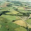
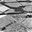
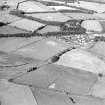
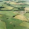
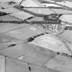
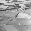
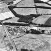
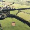
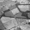
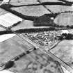
NX 951 802; NX 948 797 The Holywood cursus complex lies to the NW of Dumfries, and represents an important concentration of Neolithic field monuments. It is composed of two cursus monuments and a stone circle, the Twelve Apostles. There are also a number of minor features, which may represent ring-ditches, small enclosures, or ploughed-out mounds. Of the two cursuses, the southern example had squared terminals (NX97NW 23), while the northern one had rounded terminals (NX98SE 42). This difference in morphology may have chronological implications. Excavation in 1997 was intended to test the preservation of the monuments in the face of animal and agricultural damage over a very long period. As such, it was conceived as a sampling exercise. Large areas were opened to provide an extensive plan view of the monuments, but the total excavation of the features revealed was not contemplated. Rather, a number of features were selected, with the aim of acquiring representative sections, and samples for radiocarbon and environmental analysis.
At the northern cursus (NX98SE 42) , a cutting 60 x 40m in extent was opened over the northern terminal, while a smaller area was excavated to the S, in order to investigate an entrance in the side of the monuments. The cursus ditch was sectioned in six places, and in each case the basic sequence was one of a brief silting from the edge of the ditch, followed by a massive collapse of gravel, presumably from an internal bank, and above this a fine silting, which may have accumulated in a small recut in the top of the ditch. In the two cuttings on the eastern side of the cursus, the recut fills were sealed beneath a layer of iron pan, and this and the layer of degraded sandstone fragments above it rested on an unconformity with the earlier layers. Seemingly, a horizon of erosion preceded the renewed filling of the ditch, which may have been associated with a ploughing of the site. Numerous cut features lay within the circuit of the cursus ditch, most of these representing large post-holes. In some cases the remains of burnt posts remained, and sherds of earlier Neolithic pottery were recovered from a number of post-holes. It is likely that these posts represent a revetment for a gravel bank, which explains its catastrophic collapse into the ditch.
In contrast, the southern cursus (NX97NW 23) produced no evidence for bank revetment. Here a cutting 45 x 40m was opened, again over the northern terminal. A dump bank seemingly eroded slowly back into the U-shaped ditch. Such a bank must have covered a group of pits enclosed within the terminal of the cursus, which presumably pre-dated the monument. These contained complex fillings, much burnt material and earlier Neolithic pottery. A ring-ditch enclosed within the cursus was perhaps later in date, although it produced no dating evidence on excavation.
Geophysical survey was undertaken at the Twelve Apostles stone circle (NX 97NW 19). This produced no indication of cut features within the circuit of the stones.
Sponsor: Historic Scotland
J Thomas 1998
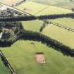
Nothing is visible of this cursus monument which was discovered by aerial photography and lies on a gently undulating ridge about 150m to the NW of Holywood School. Defined by a broad ditch, it has rounded terminals and measures some 400m from NNE to SSW by 30m overall. For much of its N half, the ditch is flanked internally by a line of pits, spaced at intervals of about 2m at the terminal, but increasing to between 4m and 5m along the sides; at the terminal, the cropmark of one pit is noticeably larger than the rest. The only entrances that have been recorded are the opposed causeways about 130m from the N terminal, but there does not appear to be a corresponding break in the arrangement of the pits. The recorded cropmarks of the S half of the cursus are not well-defined but what may be a large pit lies centrally within the S terminal. The cursus monument is plotted on a distribution map of Neolithic monuments covering southern Scotland (RCAHMS 1997, 115, fig. 110).
Information from RCAHMS (ARG), 7 April 1998
Scheduled (with NX98SE 44 and NX98SE 68 ) as 'Holywood, cursus, linear earthwork, pit alignment and enclosures'.
Information from Historic Scotland, scheduling document dated 8 September 2003.
Aerial Photographic Transcription (15 November 1990 - 12 December 1990)
An aerial transcription was produced from oblique aerial photographs. Information from Historic Environment Scotland (BM) 31 March 2017.
Aerial Photographic Transcription (1991)

