
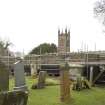
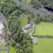
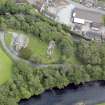
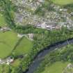
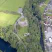
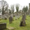
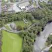
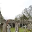
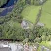
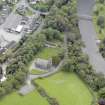
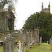
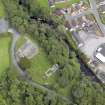
Minnigaff, Old Parish Church And Burial-ground


Burial Ground (Early Medieval), Church (Early Medieval)
Site Name Minnigaff, Old Parish Church And Burial-ground
Classification Burial Ground (Early Medieval), Church (Early Medieval)
Alternative Name(s) Minnigaff, Old Church
Canmore ID 63495
Site Number NX46NW 7
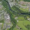
NGR NX 41016 66559
Datum OSGB36 - NGR
Permalink http://canmore.org.uk/site/63495


- Council Dumfries And Galloway
- Parish Minnigaff
- Former Region Dumfries And Galloway
- Former District Wigtown
- Former County Kirkcudbrightshire
Desk Based Assessment (29 July 1966)
NX46NW 7.00 41016 66559
(NX 4101 6656) Church (NR) (Remains of)
OS 6" map (1957)
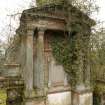
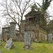
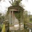
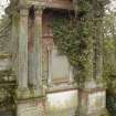
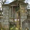
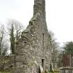
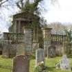
NX46NW 7.01 NX 40990 66573 Heron Monument
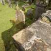
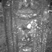
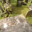
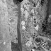
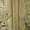
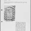
NX46NW 7.02 NX 41026 66557 Cross-slabs
For successor and present parish church (adjacent to N), see NX46NW 172.
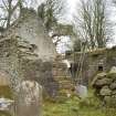
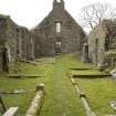
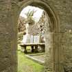
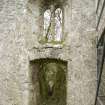
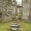
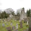
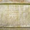
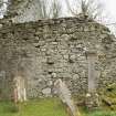
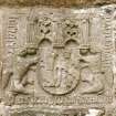
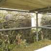
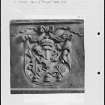
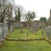
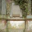
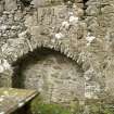
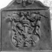
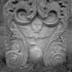
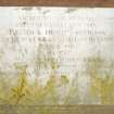
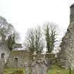
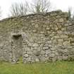
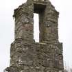
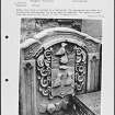
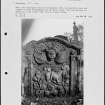
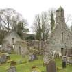
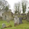
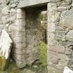
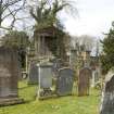
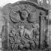
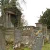
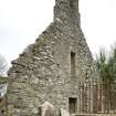
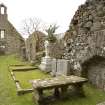
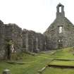
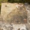
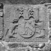
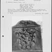
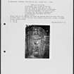
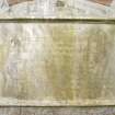
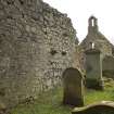
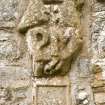
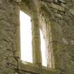
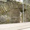
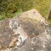
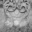
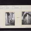
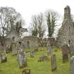
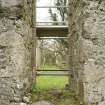
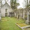
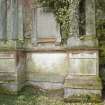
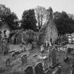
Practically nothing is known of the history of this church which was abandoned in 1836. The first recorded reference to a church here was in 1209 when its parson attested a deed. It is not described by the RCAHMS. Two cross slabs, apparently head stones of 11th century date, stand a few feet out from the wall in the NE corner of the church. One, 2ft 10ins high, and 6 1/2 to 10 1/2 ins in width, is sculptured on three sides, the front face bearing a cross, the back a fish and monster, and the right hand side the figure of a man. It was found serving as a lintel in the old market house when it was demolished about 1880. The other cross is 4ft 3ins high and 13 to 17ins in width, and bears a cross similar to the other, with 5 small dots in its centre, and below it a rough pattern of straight lines. It was found forming a doorstep to the old church.. There are two heraldic panels built into the inner side of the E wall of the church.
Information from OS (SW) 29 July 1966
J R Allen and J Anderson 1903; RCAHMS 1914; R G Collingwood 1925; R C Reid 1926
Field Visit (30 September 1966)
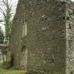
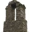
The ivy-clad walls of this church stand to roof height; measure 22.4 x 6.6m internally, and are from 0.8 to 1.1m thick. In addition to the heraldic panels mentioned (which are in the N wall) there is a stone on the outside of the E wall bearing the date '1706'. The minister, however, believes that this may be the date of a restoration or renovation.
The two cross-slabs are to be seen at NX 41026 66557.
Visited by OS (RD) 30 September 1966.
Note (24 June 2019)
The cross slabs described as being located at the Old Parish Church have been moved to Minnigaff Parish Church (NX46NW 172).
Note (21 March 2024)
A ruined church and burial ground is depicted on the 1st edition of the OS 6-inch map (1847).
Information from HES (D Watson) 21 March 2024

