Doon Of May, May
Fort (Period Unassigned)
Site Name Doon Of May, May
Classification Fort (Period Unassigned)
Canmore ID 62203
Site Number NX25SE 13
NGR NX 2950 5151
Datum OSGB36 - NGR
Permalink http://canmore.org.uk/site/62203
- Council Dumfries And Galloway
- Parish Mochrum
- Former Region Dumfries And Galloway
- Former District Wigtown
- Former County Wigtownshire
NX25SE 13 2950 5151.
(NX 2950 5150) Doon of May (NAT) Vitrified Fort (NR)
OS 6" map (1957)
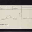
The walled settlement (R W Feachem 1965) or fort - known as the Doon of May, is an irregular ellipse, measuring 140' E-W by 100' within a heavily vitrified wall. Its facing stones have almost entirely gone, but at one point at the S, a thickness of 10' is apparent. The approach has probably been from the W. There are no indications of any outer defences.
RCAHMS 1912, visited 1911
NX 2950 5151. This fort has been left undisturbed within an area of afforestation and is generally as described above. It's defences are strengthened by steep natural rock cliffs on all but the E side. Owing to a dense cover of bracken and heather neither facing stones nor evidence of vitrifaction can be seen.
Surveyed at 1:10 000.
Visited by OS (BS) 30 June 1976
Field Visit (2 September 1951)
This site was included within the RCAHMS Marginal Land Survey (1950-1962), an unpublished rescue project. Site descriptions, organised by county, are available to view online - see the searchable PDF in 'Digital Items'. These vary from short notes, to lengthy and full descriptions. Contemporary plane-table surveys and inked drawings, where available, can be viewed online in most cases - see 'Digital Images'. The original typecripts, notebooks and drawings can also be viewed in the RCAHMS search room.
Information from RCAHMS (GFG) 19 July 2013.
Note (20 December 2013 - 23 May 2016)
Now in a small clearing in a forestry plantation and heavily overgrown, this small fortification is situated on a rocky hillock, which forms a local summit with extensive views to the W, N and E. Roughly oval on plan, it measures about 40m from E to W by 30m (0.09ha) transversely within a vitirified wall largely reduced to a stony scarp around the upper margin of the hillock. The position of the entrance is uncertain, but probably lay on the W where the access to the summit is relatively easy across the gently shelving outcrops.
Information from An Atlas of Hillforts of Great Britain and Ireland – 23 May 2016. Atlas of Hillforts SC0210


