Scheduled Maintenance
Please be advised that this website will undergo scheduled maintenance on the following dates: •
Tuesday 3rd December 11:00-15:00
During these times, some services may be temporarily unavailable. We apologise for any inconvenience this may cause.
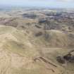
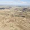
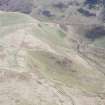
Raeshaw Fell
Linear Earthwork(S) (Period Unassigned)
Site Name Raeshaw Fell
Classification Linear Earthwork(S) (Period Unassigned)
Canmore ID 58063
Site Number NT71SE 10
NGR NT 793 133
NGR Description NT 793 132 to NT 794 139
Datum OSGB36 - NGR
Permalink http://canmore.org.uk/site/58063
- Council Scottish Borders, The
- Parish Hownam
- Former Region Borders
- Former District Roxburgh
- Former County Roxburghshire
NT71SE 10 793 132 to 794 139
See also NT71SE 13.
(A: NT 7881 1363 - NT 7934 1349) Earthwork (NR)
(B: NT 7879 1352 - NT 7935 1340) Earthwork (NR)
(C: NT 7886 1325 - NT 7925 1332) Earthwork (NR)
(D- NT 7929 1331 - NT 7934 1391) Earthwork (NR)
OS 6"map, (1962).
There are four linear earthworks on the N slopes of Raeshaw Fell. 'A', 'B', and 'C' run generally on parallel courses, one above the other, while 'D' runs N-S along the lip of Dormount Hope; it is evidently of later date than the others as it overrides 'A' and 'B' and its ditch cuts right through 'C', ending on the steep lip of the cleuch just above 'C'.
The W end of 'A' overlooks the deep valley of the Raeshaw Burn from a point about 200 yds ESE of the round clump of trees on the left bank; from here it runs ESE for some 550 yds to end on the lip of Dormount Hope. Near its W end it is traversed by a track rising from Buchtrig, and about 150 yds farther E, by another leading up the ridge of Kielhope Law; the latter track is very clearly later in date than the earthwork, but just W of where it passes the earthwork there appears a vestige of a much older terraced track which has been cut through by the ditch and is thus of earlier date. The earthwork must therefore have been built at some period later than the first passage of traffic up this hillside, though such traffic evidently continued after its construction and apparently increased in volume. E of this break the earthwork crosses the marshy hollow of the Bucht Burn, and E of this again is traversed by another old road.
The disposition of 'B' generally resembles that of 'A', from which it is distant 110 yds and 100 yds at its W and E ends respectively. Its total length is about 600 yds. It is crossed by the same tracks as 'A'. Earthwork 'C' seems to have been generally similar to 'A' and 'B' though, except at its E end where it becomes quite massive, its features are considerably obscured. Its W end is about 330 yds S of the W end of 'B', and it runs from W to E, ending at a point some 150 yds S of the end of 'B'. It is cut through, just short of its E end, by the tracks from Keilhope Law and Bucht Burn, which have coalesced.
It is difficult to see what the function of these three earthworks can have been except to mark the upper limits of lands bounded on W and E by the two valleys. But even on this hypothesis the triplication of the work is most puzzling.
Earthwork 'D' runs downhill, a little E of N, from the E end of 'C' to near Peelinick; its length is approximately 760 yds. It consists of a bank, 10' - 12' thick at the base and showing traces of stones here and there in its face, with a ditch up to 5' wide on its E or downhill side. Owing to the steepness of the slope on the lip of which it stands, the top of the bank rises in places as much as 6' above the bottom of the ditch. The position of the bank on the W side of the ditch suggests that this work may have been intended to prevent the egress of animals from Dormount Hope, but there is a gap of about a quarter of a mile between the S end of 'D' and earthwork , which breaks the continuity of a hypothetical enclosure-wall. Notwithstanding Mack's statement (J L Mack 1924) that there is in this stretch "clear evidence of yet another wall (possibly of turf)", there is actually no trace of anything beyond the deeply worn hollows of the old road, the ridges between which do in places superficially resemble a turf mound.
RCAHMS 1956, visited 1945.
As described above.
Visited by OS (WDJ) 8 September 1960.
No change.
Visited by OS (BS) 1 September 1976.
Note (30 April 2021)
The earthwork identified by the OS field surveyor as earthwork 'D' is part of the Dormount Hope Deer Trap, see NT71SE 218.
Information from HES (AKK) 30 April 2021
Sbc Note
Visibility: This is an upstanding earthwork or monument.
Information from Scottish Borders Council


