
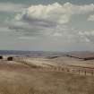
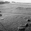
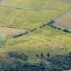
Doon Hill


Palisaded Enclosure (Neolithic), Timber Hall(S) (Neolithic)
Site Name Doon Hill
Classification Palisaded Enclosure (Neolithic), Timber Hall(S) (Neolithic)
Canmore ID 57668
Site Number NT67NE 63
NGR NT 68700 75530
Datum OSGB36 - NGR
Permalink http://canmore.org.uk/site/57668


First 100 images shown. See the Collections panel (below) for a link to all digital images.
- Council East Lothian
- Parish Dunbar
- Former Region Lothian
- Former District East Lothian
- Former County East Lothian
NT67NE 63 68700 75530.
(NT 6867 7552) Anglo-Saxon Hall (NR) (site of).
OS 6" map, (1971).
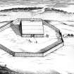
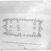
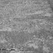
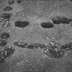
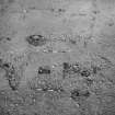
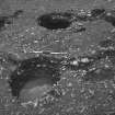
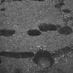
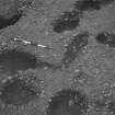
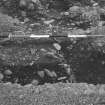
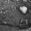
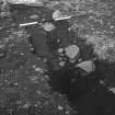
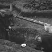
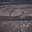
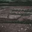
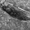
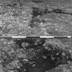
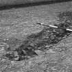
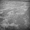
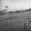
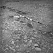
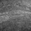
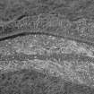
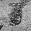
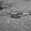
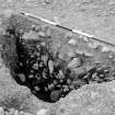
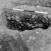
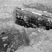
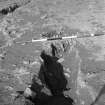
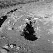
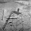
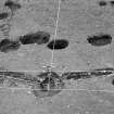
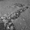
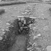
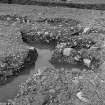
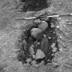
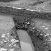
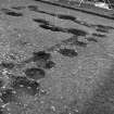
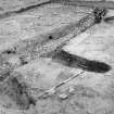
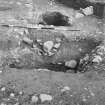
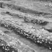
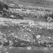
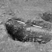
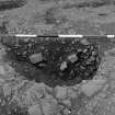
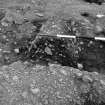
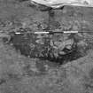
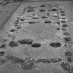
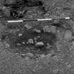
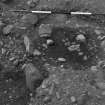
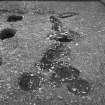
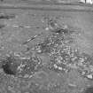
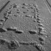
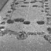
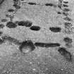
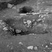
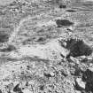
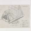
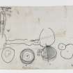
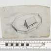
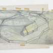
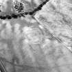
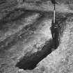
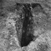
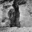
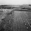
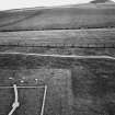
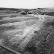
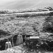
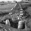
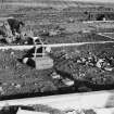
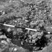
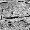
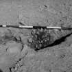
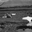
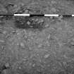
This site was first noticed on CUCAP air photographs, and was excavated by Dr Hope-Taylor from 1964-6. He showed that two timber halls (see plans) had stood successively on the same piece of ground, within a polygonal palisaded enclosure, of two corresponding structural phases. Before the construction of the halls, the site had been used as a cremation cemetery; a small square enclosure in the N part of the area appears to have been related to these burials, and so may have been a ritual structure. It is not clear whether this survived into the period of the palisaded enclosure. At a later stage a group of inhumation burials was set in place outside the palisade. The palisade itself was made of split logs, set in the ground in alternate halves with a continuous timber fence running between them.
Hall B was built after A had been destroyed by fire, and was positioned very exactly within the foundations of A. Hall B was rectangular, with an annexe at its w end. It is in many respects precisely parallel by the halls of the Oswald phase at Yeavering (NT 92 NW), and so must belong to the period around 640 AD.
Hall A was built in a different style. It was some 75ft long, with a floor in the centre each long wall, and was divided internally by two rows of three vertical posts, so that it consisted of a large compartment in the middle with a smaller one at each end. Each of the gable walls was laid out as a very obtuse V.
This hall had undergone successive repairs and must have stood for at least fifty years, and more probably a century. It can therefore be suggested that Hall A represents a native, British (pre-Anglo-Saxon) style of architecture. (cf Balbridie: NO79NW 16).
N Reynolds 1980; D M Wilson and D G Hurst 1967; Curr Archaeol 1980; RCAHMS AP catalogue 1976; G Ritchie and A Ritchie 1981.
(Carbon dating of samples from the Balbride timber structure indicate that it is Neolithic in origin, rather than an Early Historic building as previously suggested)
Information from I Ralston 1982.
RCAHMS (SO) 2003
Site surveyed at 1:2500 (while excavations were in progress).
Visited by OS (RD) 7 April 1966.
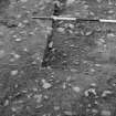
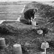
Watching Brief (25 May 2012)
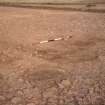
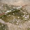
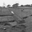
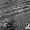
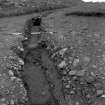
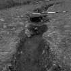
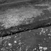
(NT 6870 7551 and NT 6871 7558) A watching brief was undertaken on 25 May 2012 during the excavation of two small trenches for information boards. No significant archaeological finds or deposits were recorded. However, as the pits and slots associated with the various configurations of halls and boundaries are relatively close to the present ground surface future work should be considered as sensitive.
Archive: RCAHMS (intended)
Funder: Historic Scotland
OASIS ID: kirkdale1-310752
Gordon Ewart, Kirkdale Archaeology 2012
Watching Brief (25 May 2012)
Under the terms of its Properties-In-Care (PIC) call-off contract with Historic Scotland, Kirkdale Archaeology was asked to maintain a watching brief during the removal and replacement of signage at Doon Hill.
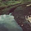
Both trenches only contained evidence of natural soil processes with no apparent archaeological activity. The soil profile reflects well drained pasture with no obvious plough soil, which presumably only represents the present, most recent 'maintenance-only' regime.
However, the pits and slots associated with the various configurations of halls and boundaries are relatively close to the present ground surface. Consequently any exposed soil, from turf downwards, should be regarded as sensitive, with some features only surviving at shallow levels, the bulk having been ploughed out.
The difficulty in recognising these features is also compounded by the compacted and homogenous natures of potential fills and the natural.
G Ewart 2012
Sponsor: Historic Scotland
Kirkdale Archaeology
Project (17 January 2019 - 19 January 2019)
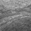
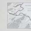
NT 68712 75550 A geophysical survey was carried out at Doon Hill (Canmore ID 57668). This survey forms part of a programme of research to increase the understanding of Doon Hill and its development. A combination of gradiometer (0.6ha), resistance (0.6ha) and ground penetrating radar (GPR) survey (0.08ha) was undertaken.
The gradiometer data has been significantly affected by the magnetic content of surface markers. However, several coherent positive anomalies have been noted which may be due to pit type features of archaeological interest. A few trends have also been recorded. However, interpretation is cautious given past excavation of the site.
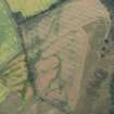
Broad rectilinear high resistance responses surrounding the halls are thought to be associated with the past excavation trenches. A cluster of responses has been recorded along the northern limits of the survey area and coincide with a pronounced mound visible on the surface. However, there is no significant magnetic response associated with these anomalies, which one might perhaps expect if they were due to settlement. Additional discrete high resistance responses have been noted throughout the survey area. While these may be of archaeological interest, these would be indicative of stone filled features or structures, not soil in-filled cut features. While an archaeological origin cannot be dismissed for all of these anomalies, it likely that most are due to natural variations in the subsoil and / or past excavation and associated activity on the site.
A block of GPR survey was undertaken adjacent to the entrance of the palisade in the east of the site. A coherent cluster of anomalies has been recorded in the north of this area and while these may be of archaeological interest, the clear change in the level of response suggests they are simply due to past excavation. However, several coherent anomalies have been noted just to the north of the entrance of the palisade which may be of archaeological interest.
Archive: NRHE
Funder: Historic Environment Scotland
Dr Susan Ovenden - Rose Geophysical Consultants
(Source: DES Vol 20)
OASIS Id: cfaarcha1-435433
Magnetometry (17 January 2019 - 19 January 2019)
NT 68712 75550 A geophysical survey was carried out at Doon Hill (Canmore ID 57668). Magnetometry survey.
Archive: NRHE
Funder: Historic Environment Scotland
Dr Susan Ovenden - Rose Geophysical Consultants
(Source: DES Vol 20)
OASIS Id: cfaarcha1-435433
Ground Penetrating Radar (17 January 2019 - 19 January 2019)
NT 68712 75550 A geophysical survey was carried out at Doon Hill (Canmore ID 57668). Ground penetrating radar survey.
Archive: NRHE
Funder: Historic Environment Scotland
Dr Susan Ovenden - Rose Geophysical Consultants
(Source: DES Vol 20)
OASIS Id: cfaarcha1-435433
Resistivity (17 January 2019 - 19 January 2019)
NT 68712 75550 A geophysical survey was carried out at Doon Hill (Canmore ID 57668). Resistivity survey.
Archive: NRHE
Funder: Historic Environment Scotland
Dr Susan Ovenden - Rose Geophysical Consultants
(Source: DES Vol 20)
OASIS Id: cfaarcha1-435433
Note (6 October 2022)
The location, classification and period of this site have been reviewed.

