
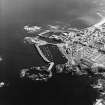
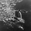
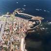
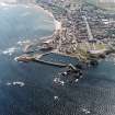
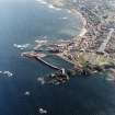
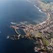
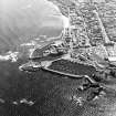
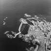
Dunbar, Victoria Street, Bernard's Maltings


Maltings (19th Century)
Site Name Dunbar, Victoria Street, Bernard's Maltings
Classification Maltings (19th Century)
Canmore ID 57609
Site Number NT67NE 137
NGR NT 68060 79209
Datum OSGB36 - NGR
Permalink http://canmore.org.uk/site/57609


- Council East Lothian
- Parish Dunbar
- Former Region Lothian
- Former District East Lothian
- Former County East Lothian
NT67NE 137 6804 7922
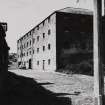
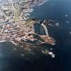
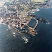
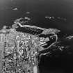
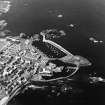
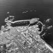
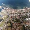
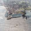
Early 18th century storehouse, three storeys high and of sandstone rubble. Now renovated and a modern apartment block.
Site recorded by GUARD during the Coastal Assessment Survey for Historic Scotland, 'The Firth of Forth from Dunbar to the Coast of Fife' 1996.
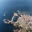
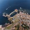
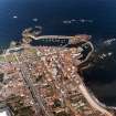
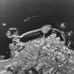
Thuis building, which stands between Victoria Street and the inner end of Broad Haven is said locally to have been built as a potato store. It encloses a court-yard and the Victoria Street frontage shows neat course rubble with droved quoins and margins, the other faces being harled. It is approximately square in plan, measuring about 105 feet 'a side'. On Victoria Street it has an arched enrtrance NE of the centre, with two doors and four windows irregularly arranged to the SW of it and a door and three windows (one blocked) to the NE. The three upper storeys each contain a range of small square windows symmetrically placed. The NE face repraets these three ranges, with a door and some windows on the ground floor where the level of the ground drops, and the NW face shows four ranges of six windows each. The SW surface is largely masked by other buildings. Visited 3 August 1965.
A Graham, 1965-6.

