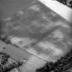
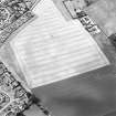
 |
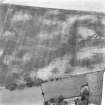
On-line Digital Images |
SC 925219 |
RCAHMS Aerial Photography |
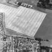
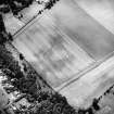
Oblique aerial view. |
1981 |
Item Level |
|
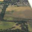 |
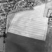
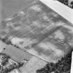
On-line Digital Images |
DP 020088 |
RCAHMS Aerial Photography Digital |
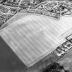
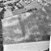
General oblique aerial view centred on the cropmarks of the settlement with the church and burial-ground adjacent, taken from the NNW. |
25/7/2006 |
Item Level |
|
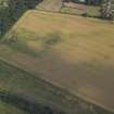 |
On-line Digital Images |
DP 020089 |
RCAHMS Aerial Photography Digital |
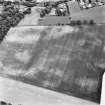
Oblique aerial view centred on the cropmarks of the settlement and the cursus, taken from the NW. |
25/7/2006 |
Item Level |
|
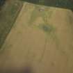 |
On-line Digital Images |
DP 020090 |
RCAHMS Aerial Photography Digital |
Oblique aerial view centred on the cropmarks of the settlement and the cursus, taken from the SW. |
25/7/2006 |
Item Level |
|
 |
On-line Digital Images |
SC 1744837 |
RCAHMS Aerial Photography |
Oblique aerial view centred on the cropmarks of the linear cropmarks and cursus, taken from the SE. |
12/8/1999 |
Item Level |
|
 |
On-line Digital Images |
SC 1744838 |
RCAHMS Aerial Photography |
Oblique aerial view centred on the cropmarks of the linear cropmarks and cursus, taken from the ENE. |
12/8/1999 |
Item Level |
|
 |
On-line Digital Images |
SC 1744839 |
RCAHMS Aerial Photography |
Oblique aerial view centred on the cropmarks of the linear cropmarks and cursus, taken from the NNE. |
12/8/1999 |
Item Level |
|
 |
On-line Digital Images |
SC 1744840 |
RCAHMS Aerial Photography |
Oblique aerial view centred on the cropmarks of the linear cropmarks and cursus, taken from the ESE. |
12/8/1999 |
Item Level |
|
 |
On-line Digital Images |
SC 1744841 |
RCAHMS Aerial Photography |
Oblique aerial view centred on the cropmarks of the linear cropmarks and cursus, taken from the E. |
12/8/1999 |
Item Level |
|
 |
On-line Digital Images |
SC 1744842 |
RCAHMS Aerial Photography |
Oblique aerial view centred on the cropmarks of the linear cropmarks and cursus, taken from the NE. |
12/8/1999 |
Item Level |
|
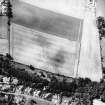 |
On-line Digital Images |
SC 1744898 |
RCAHMS Aerial Photography |
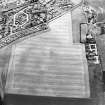
Oblique aerial view. |
1991 |
Item Level |
|
 |
On-line Digital Images |
SC 1744899 |
RCAHMS Aerial Photography |
Oblique aerial view. |
1991 |
Item Level |
|
 |
On-line Digital Images |
SC 1744900 |
RCAHMS Aerial Photography |
Oblique aerial view. |
1991 |
Item Level |
|
 |
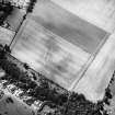
On-line Digital Images |
SC 1744996 |
RCAHMS Aerial Photography |
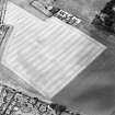
Oblique aerial view. |
1981 |
Item Level |
|
 |
On-line Digital Images |
SC 1744997 |
RCAHMS Aerial Photography |
Oblique aerial view. |
1981 |
Item Level |
|
 |
On-line Digital Images |
SC 1744998 |
RCAHMS Aerial Photography |
Oblique aerial view. |
1981 |
Item Level |
|
 |
On-line Digital Images |
SC 1744999 |
RCAHMS Aerial Photography |
Oblique aerial view. |
1981 |
Item Level |
|
 |
On-line Digital Images |
SC 1745000 |
RCAHMS Aerial Photography |
Oblique aerial view. |
1981 |
Item Level |
|
 |
On-line Digital Images |
SC 2450821 |
Records of the Ordnance Survey, Southampton, Hampshire, England |
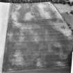
Drylawhill, NT57NE 67, Ordnance Survey index card, Recto |
1958 |
Item Level |
|


