
Gruinn Nam Marbh


Cemetery (Period Unassigned)
Site Name Gruinn Nam Marbh
Classification Cemetery (Period Unassigned)
Canmore ID 5494
Site Number NC60SE 25
NGR NC 6951 0398
Datum OSGB36 - NGR
Permalink http://canmore.org.uk/site/5494


- Council Highland
- Parish Rogart
- Former Region Highland
- Former District Sutherland
- Former County Sutherland
NC60SE 25 6951 0398.
(NC 6951 0398) Gruinn nam Marbh (NAT) (Grave Yard disused).
OS 25"map, (1968)
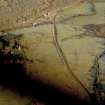
Gruinn nam Marbh the ill-preserved remains of a grave yard occupying a glacial knoll in a posture field. The graveyard wall presumably followed the periphery of the summit to enclose a roughly oval area, some 22.0 by 20.0m across, but all that is now evident is a short stretch of possibly basal outer facing walling in the south west, and sparse protruding rubble elsewhere. There may have been later quarrying in the interior. Surveyed at 1:2500.
Visited by OS (J M) 4 December 1980.

