|
Photographs and Off-line Digital Images |
A 30922 |
RCAHMS Aerial Photography |
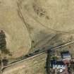
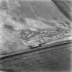
Aerial view |
1984 |
Item Level |
|
|
Photographs and Off-line Digital Images |
A 30923 |
RCAHMS Aerial Photography |
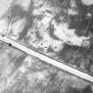
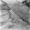
Aerial view |
1984 |
Item Level |
|
|
Photographs and Off-line Digital Images |
A 30924 |
RCAHMS Aerial Photography |
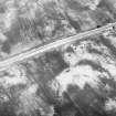
Aerial view |
1984 |
Item Level |
|
|
Photographs and Off-line Digital Images |
A 65836 |
RCAHMS Aerial Photography |
Aerial view |
1984 |
Item Level |
|
|
Photographs and Off-line Digital Images |
A 65837 |
RCAHMS Aerial Photography |
Aerial view |
1984 |
Item Level |
|
|
Photographs and Off-line Digital Images |
ML 4606 |
RCAHMS Aerial Photography |
RCAHMSAP 82 (NT212 610) |
|
Item Level |
|
|
Photographs and Off-line Digital Images |
ML 4607 |
RCAHMS Aerial Photography |
RCAHMSAP 82 (NT212 610) |
|
Item Level |
|
|
Photographs and Off-line Digital Images |
ML 4608 |
RCAHMS Aerial Photography |
RCAHMSAP 82 (NT212 610) |
|
Item Level |
|
|
Photographs and Off-line Digital Images |
ML 4609 |
RCAHMS Aerial Photography |
RCAHMSAP 82 (NT212 610) |
|
Item Level |
|
 |
On-line Digital Images |
DP 213573 |
RCAHMS Aerial Photography Digital |
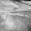
Oblique aerial view of the possible line of the Roman Road at Eight Mile Burn (NT 1930 5939), looking NNW. |
25/3/2015 |
Item Level |
|
 |
On-line Digital Images |
SC 1734091 |
RCAHMS Aerial Photography |
Aerial view |
1984 |
Item Level |
|
 |
On-line Digital Images |
SC 1734092 |
RCAHMS Aerial Photography |
Aerial view |
1984 |
Item Level |
|
 |
On-line Digital Images |
SC 1734093 |
RCAHMS Aerial Photography |
Aerial view |
1984 |
Item Level |
|
 |
On-line Digital Images |
SC 1734101 |
RCAHMS Aerial Photography |
Aerial view |
1984 |
Item Level |
|
 |
On-line Digital Images |
SC 1734102 |
RCAHMS Aerial Photography |
Aerial view |
1984 |
Item Level |
|
 |
On-line Digital Images |
SC 1734212 |
RCAHMS Aerial Photography |
RCAHMSAP 82 (NT212 610) |
|
Item Level |
|
 |
On-line Digital Images |
SC 1734213 |
RCAHMS Aerial Photography |
RCAHMSAP 82 (NT212 610) |
|
Item Level |
|
 |
On-line Digital Images |
SC 1734214 |
RCAHMS Aerial Photography |
RCAHMSAP 82 (NT212 610) |
|
Item Level |
|
 |
On-line Digital Images |
SC 1734215 |
RCAHMS Aerial Photography |
RCAHMSAP 82 (NT212 610) |
|
Item Level |
|
|
All Other |
551 166/1/1 |
Records of the Ordnance Survey, Southampton, Hampshire, England |
Archaeological site card index ('495' cards) |
1947 |
Sub-Group Level |
|


