
Wadingburn


Enclosed Settlement (Prehistoric)
Site Name Wadingburn
Classification Enclosed Settlement (Prehistoric)
Alternative Name(s) Wading Burn; Glenkevock, Enclosure
Canmore ID 51724
Site Number NT26NE 52
NGR NT 29133 65719
Datum OSGB36 - NGR
Permalink http://canmore.org.uk/site/51724


- Council Midlothian
- Parish Lasswade
- Former Region Lothian
- Former District Midlothian
- Former County Midlothian
Note (1988)
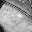
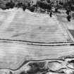
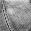
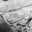
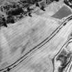
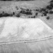
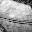
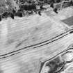
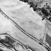
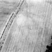
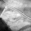
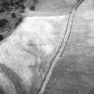
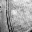
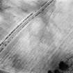
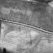
Wading Burn NT 2914 6572 NT26NE 52
A ring-ditch is revealed by cropmarks 30m SE of the road from Loanhead to Lasswade. It measures about 18m in diameter over a ditch 1.5m in breadth, and there is an entrance on the SE.
RCAHMS 1988

