
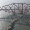
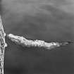
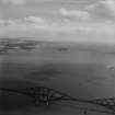
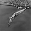
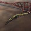
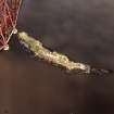
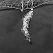
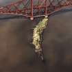
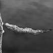
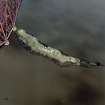
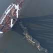
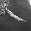
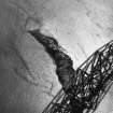
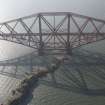
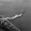
Inch Garvie


Battery (17th Century)
Site Name Inch Garvie
Classification Battery (17th Century)
Alternative Name(s) Inchgarvie; Firth Of Forth
Canmore ID 50503
Site Number NT17NW 13
NGR NT 1371 7950
Datum OSGB36 - NGR
Permalink http://canmore.org.uk/site/50503


- Council Edinburgh, City Of
- Parish Dalmeny
- Former Region Lothian
- Former District City Of Edinburgh
- Former County West Lothian
NT17NW 13 1371 7950
See also NT17NW 9 and NT17NW 10.
Inch Garvie was held by Royalists against Cromwell in 1650-1. When it was taken it was noted that there were 'fourteen pieces of ordnance' on the rock (see NT17NW 9 for further information.) The walls of the battery have been almost levelled. Having the embrasures still visible, it appears to have been built at the same time as the fort described on NT17NW 9; though it is smaller in size, it is built of similar
materials (Name Book 1854).
W S Douglas 1898.
NT 1371 7950. The only building of similar material to the fort stands slightly E of the remains of the castle (NT17NW 10). It occupies the highest point on the island, and the walls have been built up from the rock face of the cliffs. As a result, viewed from the centre of the remains of the battery, the walls appear almost level with the ground, and from the outside of the battery, the walls average 3.0m in height. The position commands an excellent view of the E, N, and S, but is overshadowed by the castle on the W.
Visited by OS (JD), 12 March 1955.
Scheduled (with NT17NW 9 and NT17NW 10) as Inch Garvie, Firth of Forth, defensive installations.
Information from Historic Scotland, scheduling document dated 19 August 1996.
Occupies the highest point of the island. The walls of the battery have been reduced in height. It was occupied by Royalist forces along with NT17NW 10 and NT17NW 9 above.
Site recorded by GUARD during the Coastal Assessment Survey for Historic Scotland, 'The Firth of Forth from Dunbar to the Coast of Fife' 1996.

