
Ward Cottage


Enclosure (Period Unassigned)
Site Name Ward Cottage
Classification Enclosure (Period Unassigned)
Canmore ID 49940
Site Number NT13SW 47
NGR NT 1395 3446
Datum OSGB36 - NGR
Permalink http://canmore.org.uk/site/49940


- Council Scottish Borders, The
- Parish Drumelzier
- Former Region Borders
- Former District Tweeddale
- Former County Peebles-shire
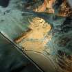
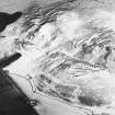
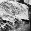
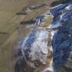
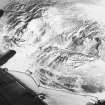
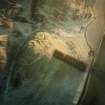
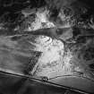
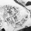
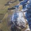
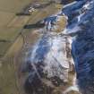
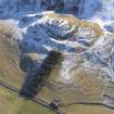
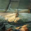
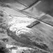
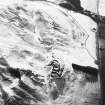
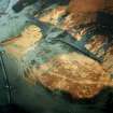
NT13SW 47 1395 3446.
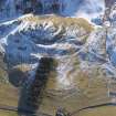
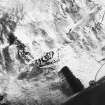
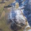
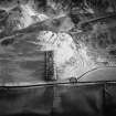
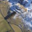
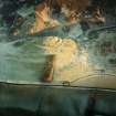
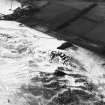
'On the slight rise to the south of Ward Cottage is a badly mutilated oval enclosure, some 30m by 50m, with traces of two ditches and intervening banks. Quarry scoops and animal trampling have severely obscured any detail, but there may be an entrance to the N. Best seen from slopes of Tinnis Castle, and only than (as when discovered) in low light and frost.'
N Fojut and P Love 1986.
Sbc Note
Visibility: This is an upstanding earthwork or monument.
Information from Scottish Borders Council

