|
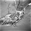
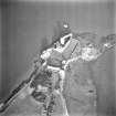
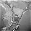
Photographs and Off-line Digital Images |
B 71564 |
RCAHMS Aerial Photography |
Aerial view. |
1991 |
Item Level |
|
|
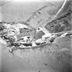
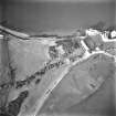
Photographs and Off-line Digital Images |
B 71565 |
RCAHMS Aerial Photography |
Aerial view. |
1991 |
Item Level |
|
|
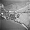
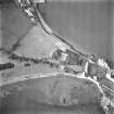
Photographs and Off-line Digital Images |
B 71566 |
RCAHMS Aerial Photography |
Aerial view. |
1991 |
Item Level |
|
|
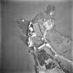
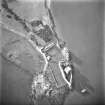
Photographs and Off-line Digital Images |
B 71567 |
RCAHMS Aerial Photography |
Aerial view. |
1991 |
Item Level |
|
|
Photographs and Off-line Digital Images |
B 71568 |
RCAHMS Aerial Photography |
Aerial view. |
1991 |
Item Level |
|
|
Photographs and Off-line Digital Images |
B 71569 |
RCAHMS Aerial Photography |
Aerial view. |
1991 |
Item Level |
|
|
Photographs and Off-line Digital Images |
B 71570 |
RCAHMS Aerial Photography |
Aerial view. |
1991 |
Item Level |
|
|
Photographs and Off-line Digital Images |
B 73540 |
RCAHMS Aerial Photography |
Aerial view. |
1992 |
Item Level |
|
|
Photographs and Off-line Digital Images |
B 73541 |
RCAHMS Aerial Photography |
Aerial view. |
1992 |
Item Level |
|
|
Manuscripts |
MS 725/138 |
Historic Scotland Archive Project |
Report of coastal assessment survey for Historic Scotland: The Firth of Forth from Dunbar to the border of Fife. (3 volumes)
Revised version with amended text. |
1996 |
Item Level |
|
|
Manuscripts |
MS 2221/05 |
Historic Scotland Archive Project |
Survey archive: List of Vertical Aerial Photographs consulted in the NMRS, from Coastal Assessment Survey, 'The Firth of Forth from Dunbar to the Coast of Fife'. |
1996 |
Item Level |
|
|
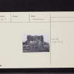
Print Room |
PA 229/3/37/1 |
G A G Peterkin |
View from W of Blackness Doocot. |
5/1977 |
Item Level |
|
 |
On-line Digital Images |
SC 1669468 |
RCAHMS Aerial Photography |
Aerial view. |
1992 |
Item Level |
|
 |
On-line Digital Images |
SC 1669469 |
RCAHMS Aerial Photography |
Aerial view. |
1992 |
Item Level |
|
 |
On-line Digital Images |
SC 1681386 |
RCAHMS Aerial Photography |
Aerial view. |
1991 |
Item Level |
|
 |
On-line Digital Images |
SC 1681387 |
RCAHMS Aerial Photography |
Aerial view. |
1991 |
Item Level |
|
 |
On-line Digital Images |
SC 1681388 |
RCAHMS Aerial Photography |
Aerial view. |
1991 |
Item Level |
|
 |
On-line Digital Images |
SC 1681389 |
RCAHMS Aerial Photography |
Aerial view. |
1991 |
Item Level |
|
 |
On-line Digital Images |
SC 1681390 |
RCAHMS Aerial Photography |
Aerial view. |
1991 |
Item Level |
|
 |
On-line Digital Images |
SC 1681391 |
RCAHMS Aerial Photography |
Aerial view. |
1991 |
Item Level |
|
 |
On-line Digital Images |
SC 1681392 |
RCAHMS Aerial Photography |
Aerial view. |
1991 |
Item Level |
|
 |
On-line Digital Images |
SC 2437752 |
Records of the Ordnance Survey, Southampton, Hampshire, England |
Blackness Castle, Dovecot, NT08SE 11, Ordnance Survey index card, Recto |
1958 |
Item Level |
|
 |
On-line Digital Images |
SC 2437753 |
Records of the Ordnance Survey, Southampton, Hampshire, England |
Blackness Castle, Dovecot, NT08SE 11, Ordnance Survey index card, Recto |
1958 |
Item Level |
|
 |
On-line Digital Images |
SC 2437754 |
Records of the Ordnance Survey, Southampton, Hampshire, England |
Blackness Castle, Dovecot, NT08SE 11, Ordnance Survey index card, Recto |
1958 |
Item Level |
|


