|
Print Room |
RAB 343/OP131/2 |
General Collection |
Engraving of the Mill Port and adjacent buildings, from the south 1627. Shows 2 storey houses on left with outside steps,cobbled road through archway with adjoining building. |
1859 |
Item Level |
|
|
Manuscripts |
MS 7830 |
Records of Rathmell Archaeology Ltd, archaeologists, Kilbarchan, Renfrewshire, Scotland |
Report: 'Southern Gateway, Dunfermline: Archaeological Mitigation. Data Structure Report' |
25/2/2008 |
Item Level |
|
 |
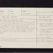
On-line Digital Images |
SC 2437511 |
Records of the Ordnance Survey, Southampton, Hampshire, England |
Dunfermline, Mill Port, NT08NE 9, Ordnance Survey index card, Recto |
1958 |
Item Level |
|
 |
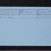
On-line Digital Images |
SC 2437512 |
Records of the Ordnance Survey, Southampton, Hampshire, England |
Dunfermline, Mill Port, NT08NE 9, Ordnance Survey index card, Recto |
1958 |
Item Level |
|
|
All Other |
551 166/1/1 |
Records of the Ordnance Survey, Southampton, Hampshire, England |
Archaeological site card index ('495' cards) |
1947 |
Sub-Group Level |
|


