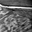
|
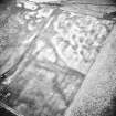
Photographs and Off-line Digital Images |
A 29894 |
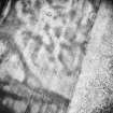
RCAHMS Aerial Photography |
Oblique aerial view. |
1986 |
Item Level |
|
|
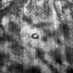
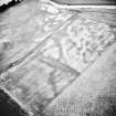
Photographs and Off-line Digital Images |
A 29895 |
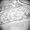
RCAHMS Aerial Photography |
Oblique aerial view. |
1986 |
Item Level |
|
|
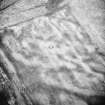
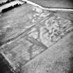
Photographs and Off-line Digital Images |
A 29896 |
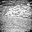
RCAHMS Aerial Photography |
Oblique aerial view. |
1986 |
Item Level |
|
|
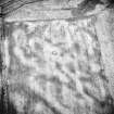
Photographs and Off-line Digital Images |
A 29897 |
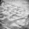
RCAHMS Aerial Photography |
Oblique aerial view. |
1986 |
Item Level |
|
|
Photographs and Off-line Digital Images |
A 29898 |
RCAHMS Aerial Photography |
Oblique aerial view. |
1986 |
Item Level |
|
|
Photographs and Off-line Digital Images |
A 29899 |
RCAHMS Aerial Photography |
Oblique aerial view. |
1986 |
Item Level |
|
|
Photographs and Off-line Digital Images |
A 29900 |
RCAHMS Aerial Photography |
Oblique aerial view. |
1986 |
Item Level |
|
|
Photographs and Off-line Digital Images |
A 29901 |
RCAHMS Aerial Photography |
Oblique aerial view. |
1986 |
Item Level |
|
|
Photographs and Off-line Digital Images |
A 29902 |
RCAHMS Aerial Photography |
Oblique aerial view. |
1986 |
Item Level |
|
|
Manuscripts |
MS 840/349 |
RCAHMS Aerial Transcription |
Transcription file |
1992 |
Item Level |
|
 |
On-line Digital Images |
SC 342739 |
|
Aerial photograph - cropped. |
|
Item Level |
|
 |
On-line Digital Images |
SC 342740 |
|
Aerial photograph - cropped. |
|
Item Level |
|
|
Manuscripts |
MS 726/129 |
Records of CFA Archaeology Ltd, archaeologists, Musselburgh, East Lothian, Scotland |
Annieston, Symington, Clydesdale District: phase 1 archaeological assessment, commissioned by Lovie Ltd. (Starmin Scotland), May-June 1992. (Report no. 77). |
1992 |
Item Level |
|
|
Manuscripts |
MS 726/130 |
Records of CFA Archaeology Ltd, archaeologists, Musselburgh, East Lothian, Scotland |
Annieston, Symington, Clydesdale District: archaeological excavation, commissioned by Tinto Sand and Gravel Ltd, March 1995. (Report no. 212). |
1995 |
Item Level |
|
 |
On-line Digital Images |
SC 1729982 |
RCAHMS Aerial Photography |
Oblique aerial view. |
1986 |
Item Level |
|
 |
On-line Digital Images |
SC 1729983 |
RCAHMS Aerial Photography |
Oblique aerial view. |
1986 |
Item Level |
|
 |
On-line Digital Images |
SC 1729984 |
RCAHMS Aerial Photography |
Oblique aerial view. |
1986 |
Item Level |
|
 |
On-line Digital Images |
SC 1729985 |
RCAHMS Aerial Photography |
Oblique aerial view. |
1986 |
Item Level |
|
 |
On-line Digital Images |
SC 1729986 |
RCAHMS Aerial Photography |
Oblique aerial view. |
1986 |
Item Level |
|
 |
On-line Digital Images |
SC 1729987 |
RCAHMS Aerial Photography |
Oblique aerial view. |
1986 |
Item Level |
|
 |
On-line Digital Images |
SC 1729988 |
RCAHMS Aerial Photography |
Oblique aerial view. |
1986 |
Item Level |
|
 |
On-line Digital Images |
SC 1729989 |
RCAHMS Aerial Photography |
Oblique aerial view. |
1986 |
Item Level |
|
 |
On-line Digital Images |
SC 1729990 |
RCAHMS Aerial Photography |
Oblique aerial view. |
1986 |
Item Level |
|
 |
On-line Digital Images |
SC 2436170 |
Records of the Ordnance Survey, Southampton, Hampshire, England |
Clachan Burn, NT03NW 61, Ordnance Survey index card, Recto |
1958 |
Item Level |
|


