
Milton


Fortlet (Roman), Roman Fort (Roman), Temporary Camp(S) (Roman)(Possible)
Site Name Milton
Classification Fortlet (Roman), Roman Fort (Roman), Temporary Camp(S) (Roman)(Possible)
Alternative Name(s) Milton Of Tassieholm
Canmore ID 48383
Site Number NT00SE 22
NGR NT 09233 01419
Datum OSGB36 - NGR
Permalink http://canmore.org.uk/site/48383


- Council Dumfries And Galloway
- Parish Kirkpatrick-juxta
- Former Region Dumfries And Galloway
- Former District Annandale And Eskdale
- Former County Dumfries-shire
NT00SE 22 09233 01419
(Name: NT 0920 0141) ROMAN FORT (R) (Site of)
(NT 0919 0118) ROMAN FORTLET (R)
OS 6" map, (1957)
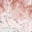
A major Roman complex (Flavian to Antonine - see Map Diagram for details of elements and phases) at Milton (Roy's Tassieholm) was excavated between 1938 and 1950 by J. Clarke. In addition to the planned forts, fortlets, camps, etc., he mentions the ditch system of a probable annexe NW of North Fort 2; and a probable parade ground, an entrenched block-house, and what looks like the corner of a temporary camp, all near the wood towards the NE of the site.
Clarke's findings suggest that the considerable permanent or semi-permanent oblique fort (shown in red on Map Diagram) was abandoned some years before the well-known Agricolan advance, and it would appear, therefore, that the Romans penetrated thus far during the Brigantian campaigns under Cerialis. In the later phases, if North Fort 2 is comparable, as seems probable, with Loudoun Hill, the approximate date of evacuation would be A.D. 100, and the fortlet (yellow on Map Diagram) followed. Although the evidence is far from conclusive, Clarke favours an early date for the oblique fort and says that some adjustment of ideas on both the beginning and end of the first Roman period in Scotland may be necessary.
J Clarke 1948; 1951
The only part of this complex now extant is the Antonine road post, which exists as a scarp c 1.2m high enclosing an area c 44m E-W by 28m N-S. Slight unsurveyable rises and depressions represent part of the remainder of the complex.
Visited by OS (D W R) 9 December 1971.
Note (1997)
NT 0920 0138 NT00SE 22
Listed as settlement (probable) within Roman fort, also fortlet, enclosures and temporary camp. Locations cited as:
NT 0924 0142 Fort
NT 0920 0118 Fortlet
NT 0920 0120 Enclosures
NT 0925 0099 Temporary camp
RCAHMS 1997.
Publication Account (17 December 2011)
The forts, fortlet and camp at Milton lie in the upper reaches of the River Annan, close to its confluence with the Evan Water and Moffat Water. The site, recorded by Roy as ‘Tassiesholm’ (1793: Pl. VIII), sits on a low ridge and comprises a Flavian fort of two phases with annexes, and an Antonine fortlet with probably two phases enclosed by a trapezoidal palisaded enclosure (Clarke 1951). To the south of the fortlet lies a small camp (Milton I), and a possible camp may lie under the forts (Milton II, see probable camps below – Clarke 1951: 199). Some 700m north-west of the fort and on the valley floor of the Evan Water, lies a series of large camps at Beattock.
The camp was discovered in 1949 by St Joseph as a cropmark from the air, lying around 300m south of the fort. It measures 174m from ENE to WSW by 138m and enclosed 2.2ha (5.4 acres). Entrance gaps protected by tituli are visible in the WSW, SSE and ENE sides. Two small trenches excavated in 1950 revealed that the ditch was some 2.1m in width, inside which was a 0.9m trench assumed to be for a palisade (Clarke 1951: 214).
R H Jones.
Publication Account (17 December 2011)
A possible camp at Milton was recorded under the east intervallum street of the Roman fort in 1950 during excavations by Clarke (1951: 199). Little is known of its extent, but the ditch was recorded as measuring some 2.1m wide and as being gravel-filled without silting.
R H Jones.

