
Myreton Hill


Building (Post Medieval), Enclosure (Post Medieval), Hut (Post Medieval)(Possible)
Site Name Myreton Hill
Classification Building (Post Medieval), Enclosure (Post Medieval), Hut (Post Medieval)(Possible)
Canmore ID 47095
Site Number NS89NE 47
NGR NS 8507 9792
Datum OSGB36 - NGR
Permalink http://canmore.org.uk/site/47095


- Council Clackmannan
- Parish Alva
- Former Region Central
- Former District Clackmannan
- Former County Clackmannanshire
Field Visit (1970)
NS89NE 47 8507 9792
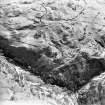
At the foot of Myreton Hill about 300m S of First Inchna Burn are the tumbled remains of a dwelling overall 9m x 6m. There is also a network of enclosures and tracks adjacent.
T C Welsh 1970
Field Visit (16 June 1997)
NS89NE 47 8507 9792
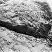
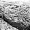
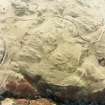
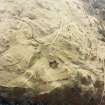
The robbed footings of a subrectangular building are situated on a grassy ridge beside the modern hill track. The building measures 10.3m from NNW to SSE by 3.2m within a robbed stony wall spread to 0.7m in thickness and 0.3m in height. A subrectangular enclosure lies at the base of the ridge to the E; it has not been robbed and may post date the building. Some 9.6m along the ridge to the N of the building there is a subrectangular depression which may have been a hut.
(MENS97 160)
Visited by RCHAMS (DCC) 16 June 1997

