 |
Digital Files (Non-image) |
WP 003887 |
Publications by the Royal Commission on the Ancient and Historical Monuments of Scotland |
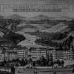
Exploring Scotland's Heritage: Clyde Estuary And Central Region |
1985 |
Item Level |
|
 |
Digital Files (Non-image) |
WP 004018 |
Records of Kirkdale Archaeology Ltd, archaeologists, Edinburgh, Scotland |
Archaeological watching brief at Rough Castle, Falkirk and Croy Hill, North Lanarkshire |
3/1997 |
Item Level |
|
|
Digital Files (Non-image) |
GV 007519 |
Records of Historic Scotland, Edinburgh, Scotland |
Map 3 of 8 from IV.I 1-8 - Series 1: Maps of the Antonine Wall at a scale of 1:25000 showing the proposed World Heritage Site, known forts and fortlets, camps, other features and the buffer zones. Maps were prepared for the nomination document to propose the extension of the Frontiers of the Roman Empire World Heritage Site through the addition of the Antonine Wall. |
2006 |
Item Level |
|
|
Digital Files (Non-image) |
GV 007526 |
Records of Historic Scotland, Edinburgh, Scotland |
Map 3 of 8 from IV.2 1-8 - Series 2: Maps of the Antonine Wall at a scale of 1:25000 showing the proposed World Heritage Site, known forts and fortlets, camps, other features and the buffer zones. Maps were prepared for the nomination document to propose the extension of the Frontiers of the Roman Empire World Heritage Site through the addition of the Antonine Wall. |
2006 |
Item Level |
|
|
Digital Files (Non-image) |
GV 007546 |
Records of Historic Scotland, Edinburgh, Scotland |
Map 13 of 39 from Series V. Maps of the Antonine Wall and its known features at a scale of 1:5000 showing the scheduled areas and the proposed World Heritage Site. Maps were prepared for the nomination document to propose the extension of the Frontiers of the Roman Empire World Heritage Site through the addition of the Antonine Wall. |
2006 |
Item Level |
|
|
Digital Files (Non-image) |
GV 007596 |
Records of Historic Scotland, Edinburgh, Scotland |
Antonine Wall 1:25000 broadsheet map - created in three sections - this is the eastern section of the map |
2008 |
Item Level |
|
|
Digital Files (Non-image) |
TM 000310 |
Records of Historic Scotland, Edinburgh, Scotland |
Zip file including: a Dxf file containing the polygons created to show the components of the Antonine Wall, along with the associated forts, expansions and military way. Shapefiles containing the same data and an associated layer file. |
2007 |
Item Level |
|
|
Digital Files (Non-image) |
MV 000858 |
Historic Environment Scotland |
UAV video: Rough Castle Roman fort |
19/3/2018 |
Item Level |
|
|
Digital Files (Non-image) |
MV 000859 |
Historic Environment Scotland |
UAV video: Rough Castle Roman fort |
19/3/2018 |
Item Level |
|
|
Digital Files (Non-image) |
MV 000860 |
Historic Environment Scotland |
UAV video: Rough Castle Roman fort |
19/3/2018 |
Item Level |
|
|
Digital Files (Non-image) |
MV 000861 |
Historic Environment Scotland |
UAV video: Rough Castle Roman fort |
19/3/2018 |
Item Level |
|
|
Digital Files (Non-image) |
MV 000862 |
Historic Environment Scotland |
UAV video: Rough Castle Roman fort |
19/3/2018 |
Item Level |
|
|
Digital Files (Non-image) |
MV 000863 |
Historic Environment Scotland |
UAV video: Rough Castle Roman fort |
19/3/2018 |
Item Level |
|
|
Digital Files (Non-image) |
MV 000864 |
Historic Environment Scotland |
UAV video: Rough Castle Roman fort |
19/3/2018 |
Item Level |
|
|
Digital Files (Non-image) |
GV 008531 |
Records of Historic Scotland, Edinburgh, Scotland |
Map showing the Antonine Wall, the World Heritage Site area, the areas of the World Heritage Site in public ownership or care, the Buffer Zone and the Council boundaries. Created for the World Heritage Site nomination - Management plan. |
2006 |
Item Level |
|
|
Digital Files (Non-image) |
TM 002308 |
Historic Environment Scotland |
LiDAR Hillshade image of area north of Rough Castle Roman fort |
11/12/2023 |
Item Level |
|


