
Pricing Change
New pricing for orders of material from this site will come into place shortly. Charges for supply of digital images, digitisation on demand, prints and licensing will be altered.
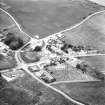
Crawfordjohn


Burgh (Medieval), Village (Period Unassigned)
Site Name Crawfordjohn
Classification Burgh (Medieval), Village (Period Unassigned)
Canmore ID 46444
Site Number NS82SE 10
NGR NS 879 238
NGR Description Centred NS 879 238
Datum OSGB36 - NGR
Permalink http://canmore.org.uk/site/46444


- Council South Lanarkshire
- Parish Crawfordjohn
- Former Region Strathclyde
- Former District Clydesdale
- Former County Lanarkshire

