
Unst, Burragarth


Standing Stone (Prehistoric)
Site Name Unst, Burragarth
Classification Standing Stone (Prehistoric)
Canmore ID 46
Site Number HP50SE 26
NGR HP 5754 0395
Datum OSGB36 - NGR
Permalink http://canmore.org.uk/site/46


- Council Shetland Islands
- Parish Unst
- Former Region Shetland Islands Area
- Former District Shetland
- Former County Shetland
HP50SE 26 5754 0395
(HP 5754 0397) Standing Stone (NR).
OS 6" map, Shetland, 2nd ed., (1900).
See also HP50SE 9.
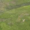
A rough quadrangular boulder with no clear evidence of packing at base. It stands 3' high and has a girth of 7' at base. It is locally supposed to have been a boundary stone.
OS Name Book 1878; RCAHMS 1946, visited 1930.
As described by the RCAHMS: almost certainly a boundary stone.
Visited by OS (NKB), 5 May 1969.
Using the 4m high standing stone described on HP50SE 9 as backsight, this 1m high standing stone at a distance of 0.7km to the NNW, acts as skyline foresight for a hitherto unnoticed lunar alignment with declination 28'.629.
H Exton 1994b.

