 |
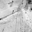
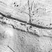
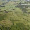
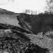
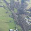
On-line Digital Images |
SC 355732 |
RCAHMS Aerial Photography |
Aerial view |
1984 |
Item Level |
|
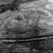 |
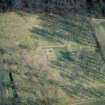
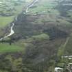
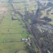
On-line Digital Images |
SC 355752 |
|
Aerial view |
|
Item Level |
|
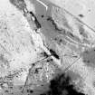 |
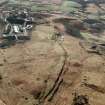
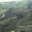
On-line Digital Images |
SC 355759 |
RCAHMS Aerial Photography |
Aerial view |
1984 |
Item Level |
|
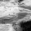 |
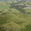
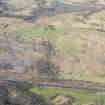
On-line Digital Images |
SC 355760 |
RCAHMS Aerial Photography |
Aerial view |
1984 |
Item Level |
|
 |
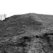
On-line Digital Images |
SC 355761 |
|
Oblique aerial view |
|
Item Level |
|
 |
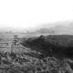
On-line Digital Images |
SC 902932 |
RCAHMS Aerial Photography |
Oblique aerial view of Bar Hill Roman Fort interior and the Antonine Wall, taken from the W. |
4/3/1997 |
Item Level |
|
 |
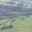
On-line Digital Images |
SC 1029515 |
RCAHMS Aerial Photography |
Aerial view of Antonine Wall at Croy Hill (c. 736 768), taken from the NE. |
4/3/1997 |
Item Level |
|
 |
On-line Digital Images |
DP 014282 |
RCAHMS Aerial Photography Digital |
General oblique aerial view centred on the course of the Antonine Wall with the village in the distance, taken from the WNW. |
3/8/2006 |
Item Level |
|
 |
On-line Digital Images |
DP 014283 |
RCAHMS Aerial Photography Digital |
General oblique aerial view centred on the course of the Antonine Wall with the village in the distance, taken from the W. |
3/8/2006 |
Item Level |
|
 |
On-line Digital Images |
DP 020989 |
RCAHMS Aerial Photography Digital |
General oblique aerial view centred on the course of the Antonine Wall and the quarry with the site of the Roman fortlet adjacent, taken from the SW. |
8/9/2006 |
Item Level |
|
 |
On-line Digital Images |
DP 020990 |
RCAHMS Aerial Photography Digital |
General oblique aerial view centred on the course of the Antonine Wall and the quarry with the site of the Roman fortlet adjacent, taken from the WSW. |
8/9/2006 |
Item Level |
|
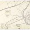 |
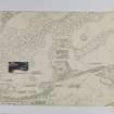
On-line Digital Images |
DP 051446 |
Records of the Royal Commission on the Ancient and Historical Monuments of Scotland (RCAHMS), Edinbu |
Antonine Wall Ordnance Survey 1954-57 working sheets map sheet 20 |
c. 1957 |
Item Level |
|
 |
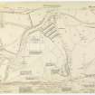
On-line Digital Images |
DP 051447 |
Records of the Royal Commission on the Ancient and Historical Monuments of Scotland (RCAHMS), Edinbu |
Antonine Wall Ordnance Survey 1954-57 working sheets map sheet 21 |
c. 1957 |
Item Level |
|
 |
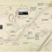
On-line Digital Images |
DP 051448 |
Records of the Royal Commission on the Ancient and Historical Monuments of Scotland (RCAHMS), Edinbu |
Antonine Wall Ordnance Survey 1954-57 working sheets map sheet 22 |
c. 1957 |
Item Level |
|
 |
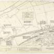
On-line Digital Images |
DP 051449 |
Records of the Royal Commission on the Ancient and Historical Monuments of Scotland (RCAHMS), Edinbu |
Antonine Wall Ordnance Survey 1954-57 working sheets map sheet 23 |
c. 1957 |
Item Level |
|
 |
On-line Digital Images |
DP 051450 |
Records of the Royal Commission on the Ancient and Historical Monuments of Scotland (RCAHMS), Edinbu |
Antonine Wall Ordnance Survey 1954-57 working sheets map sheet 24 |
c. 1957 |
Item Level |
|
 |
On-line Digital Images |
DP 051503 |
Records of the Royal Commission on the Ancient and Historical Monuments of Scotland (RCAHMS), Edinbu |
Antonine Wall Ordnance Survey 1954-57 working sheets map sheet 21 |
c. 1957 |
Item Level |
|
 |
On-line Digital Images |
DP 051504 |
Records of the Royal Commission on the Ancient and Historical Monuments of Scotland (RCAHMS), Edinbu |
Antonine Wall Ordnance Survey 1954-57 working sheets map sheet 23 |
c. 1957 |
Item Level |
|
 |
On-line Digital Images |
DP 051505 |
Records of the Royal Commission on the Ancient and Historical Monuments of Scotland (RCAHMS), Edinbu |
Antonine Wall Ordnance Survey 1954-57 working sheets map sheet 23 |
c. 1957 |
Item Level |
|
 |
On-line Digital Images |
DP 249541 |
Historic Environment Scotland |
Oblique aerial view. |
24/3/2017 |
Item Level |
|
 |
On-line Digital Images |
DP 249542 |
Historic Environment Scotland |
Oblique aerial view. |
24/3/2017 |
Item Level |
|
 |
On-line Digital Images |
DP 249543 |
Historic Environment Scotland |
Oblique aerial view. |
24/3/2017 |
Item Level |
|
 |
On-line Digital Images |
DP 249544 |
Historic Environment Scotland |
Oblique aerial view. |
24/3/2017 |
Item Level |
|
 |
On-line Digital Images |
DP 249545 |
Historic Environment Scotland |
Oblique aerial view. |
24/3/2017 |
Item Level |
|


