Darngaber Castle
Motte (Medieval)
Site Name Darngaber Castle
Classification Motte (Medieval)
Canmore ID 45737
Site Number NS75SW 5
NGR NS 7294 5008
Datum OSGB36 - NGR
Permalink http://canmore.org.uk/site/45737
- Council South Lanarkshire
- Parish Hamilton (South Lanarkshire)
- Former Region Strathclyde
- Former District Hamilton
- Former County Lanarkshire
NS75SW 5 7294 5008.
(NS 7294 5008) Site of Darngaber Castle (NR)
OS 6" map (1913)
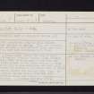
The foundations only of this ancient fortress can now be traced. They are entirely of flat shingly stones without lime, and seem never to have been subjected to a tool.
Name Book 1858
A flat-topped mound, the top of which is an irregular circular shape, 17.0m average diameter, with level ground to the S.W. and with steep slopes on all other sides. A large number of flat stones,unworked, area scattered on and around the mound, on the north side of which is a slight ditch, and rampart 0.4m high. On this rampart and extending from C-D are traces of unbonded stone foundations. A typical medieval motte.
Visited by OS (JFC) 25 February 1954
The mound, described above has been quarried in to, and is covered in trees and dense vegetation. The rubble-filled bank on the north side lies on a steep slope and is very slight, so as to suggest a doubtful part of the antiquity.
Surveyed at 1:2500.
Visited by OS (JLD) 16 June 1959


