Mote Hill, Hamilton Low Parks
Motte And Bailey (Medieval)
Site Name Mote Hill, Hamilton Low Parks
Classification Motte And Bailey (Medieval)
Alternative Name(s) Netherton Motte
Canmore ID 45683
Site Number NS75NW 4
NGR NS 72695 56619
Datum OSGB36 - NGR
Permalink http://canmore.org.uk/site/45683
- Council South Lanarkshire
- Parish Hamilton (South Lanarkshire)
- Former Region Strathclyde
- Former District Hamilton
- Former County Lanarkshire
NS75NW 4 72695 56619
Mote Hill (NR)
OS 6" map
Sculptured figure on top of Mote Hill.
OS 6" map annotated by O G S Crawford.
Location formerly entered as NS 7270 5662.
A castle mound, no ditch. The sculptured stone is a fragment of the leg of Hercules (?) wth lion's skin, of local stone and modern.
OS 6" map annotated by O G S Crawford, May 1939.
Mote Hill: little or nothing is known of the history of this hill.
Visited by OS (JLD) 4 August 1953
Hamilton Civic Soc 1932; A G Millar 1941.
Probable Medieval mote: situated on low-lying ground is this small, flat-topped mound with considerably spread slopes. Its maximum height above the adjacent ground level is 2.5 metres, while its diameter on top averages 18.2 metres. As stated by OS (JLD), there is no ditch visible. A photograph was impracticable due to dense vegetation obscuring the detail. The sculptured stone mentioned, lies broken on the summit, but is quite modern.
This is certainly an artificially constructed mound, and appears to be a small mote. No other information or evidence was found during investigation.
Visited by OS (JLD) 8 September 1953.
Scheduled as 'Hamilton Low Parks, motte... the remains of a medieval motte and bailey castle, surviving as substantial earthworks, and as buried archaeology, together with an area enclosing the outer defences.'
Information from Historic Scotland, scheduling document dated 26 February 2003.
Motte [NAT]
OS (GIS) MasterMap, April 2010.
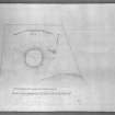
Measured Survey (11 October 1973)
RCAHMS surveyed the motte at Hamilton Low Parks in 1973.
Publication Account (1996)
In Hamilton Parks, north-east of modern Hamilton near to the Clyde, there is a motte. This is all that remains of an early fortified structure (see area 1 & gazetteer) and it can be presumed that the early settlement clustered around this site. Settlers would have been attracted here because a fortified building offered a measure of protection to those nearby, while the castle and its occupants would have looked to their neighbours for labour and a supply of basic necessities. This is probably the first settlement site of Cadzow, or Hamilton as it became called-the Nethertoun.
Information from ‘Historic Hamilton: The Archaeological Implications of Development’ (1996).


